Edge Case · RMIT · Semester 2, 2024
Chrono-Suburban
Living
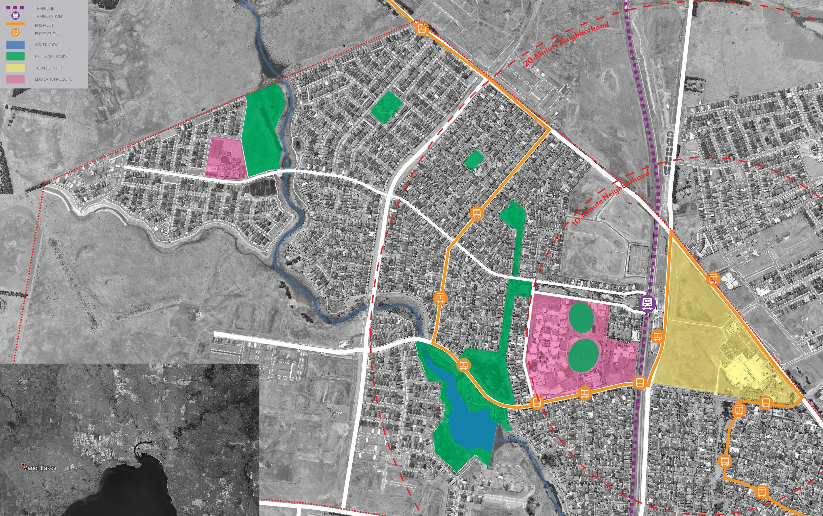
How does Melbourne's official 20-minute neighbourhood model perform in outer suburbs designed for cars? And what would the more ambitious 10-minute model require to work there? Manor Lakes, 35 kilometres west of the CBD, becomes the test case for a quantitative argument about time, access, and the shape of livable cities.
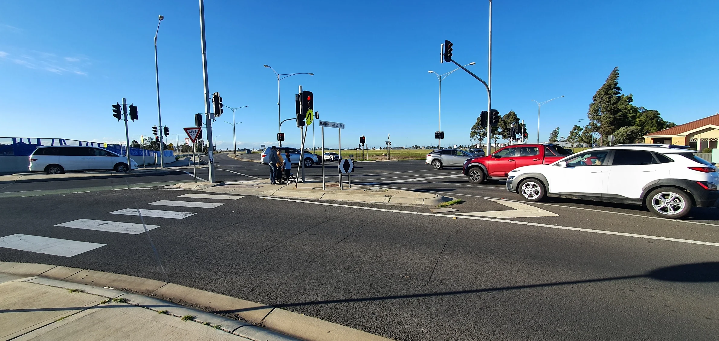
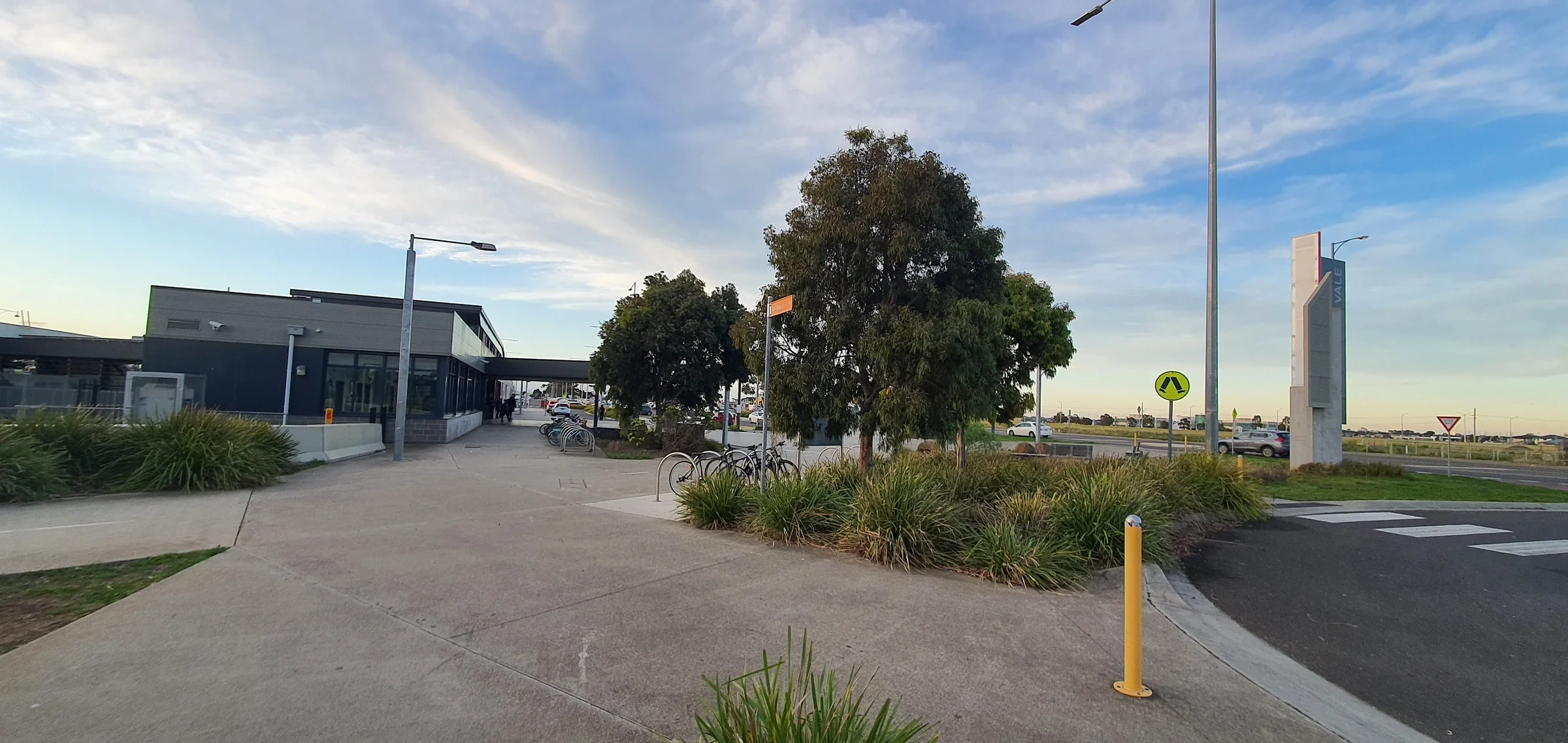
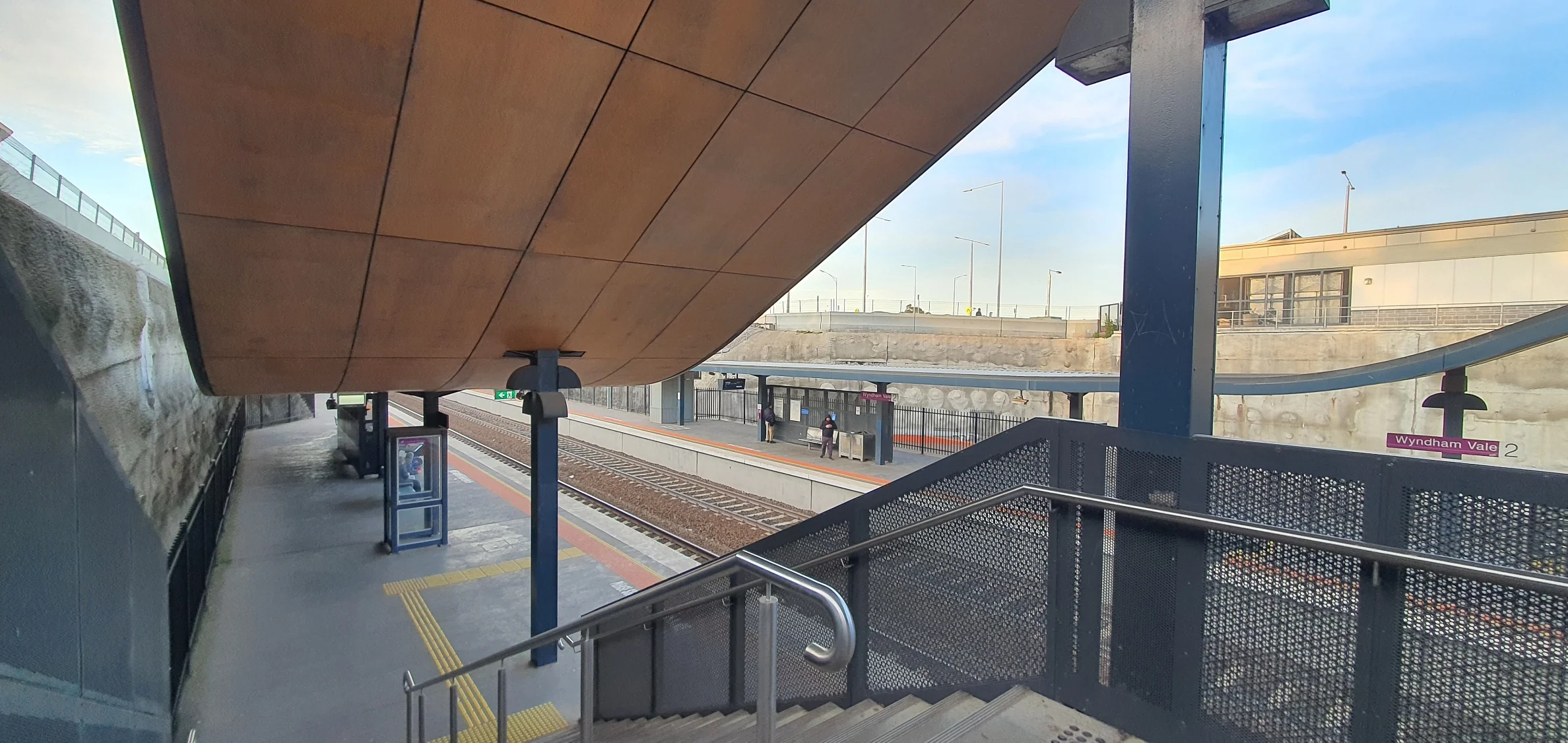
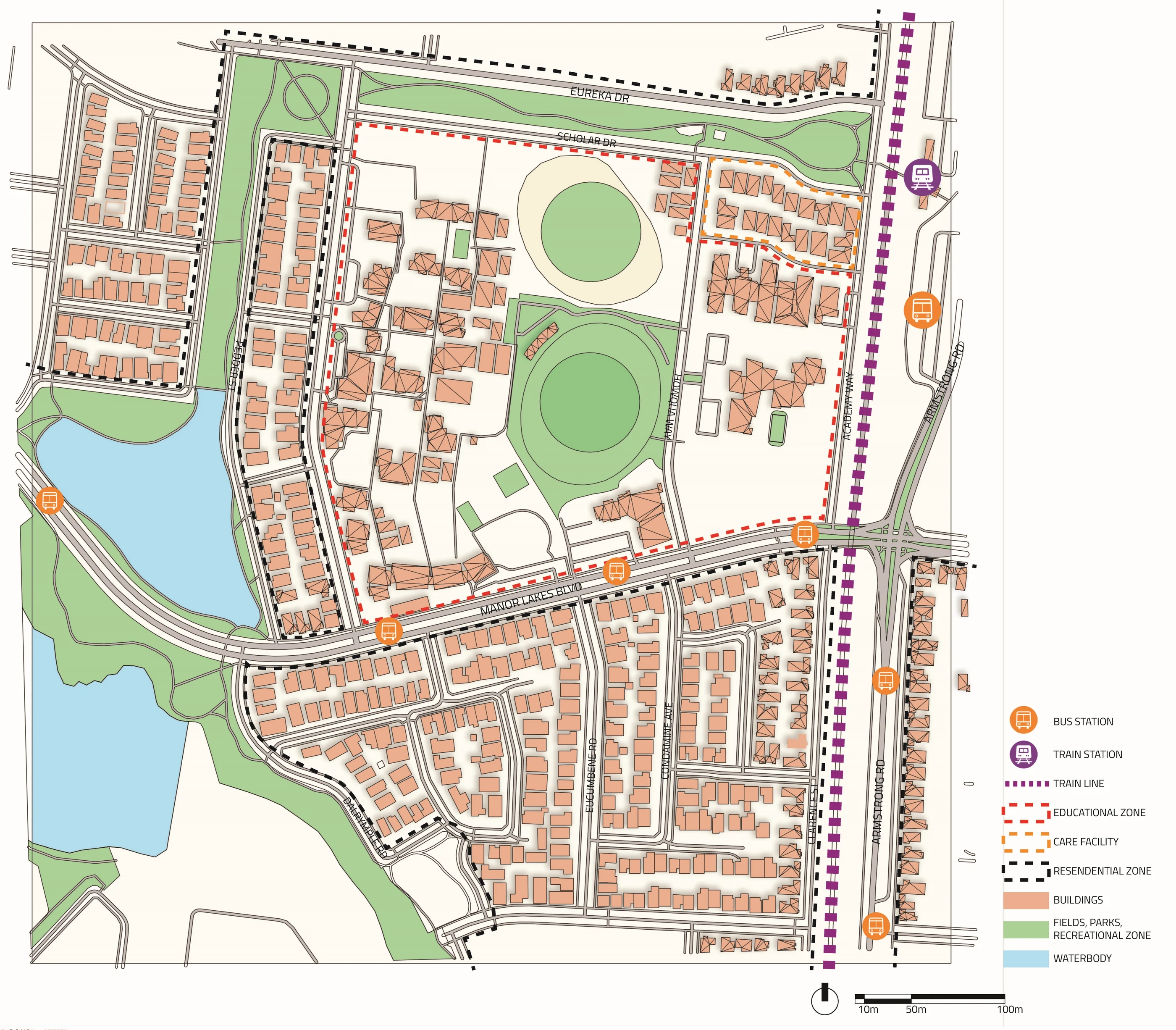
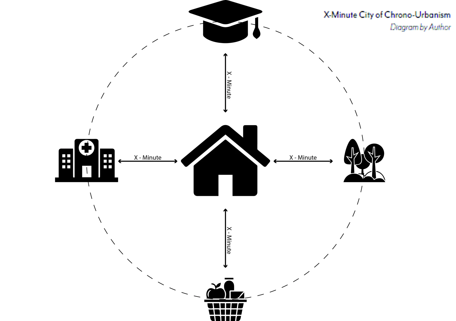
Chrono-urbanism: the planning philosophy that organises cities around time rather than distance. Not "how far is the supermarket?" but "how long does it take to get there, and by what means?" Manor Lakes scores poorly by this measure. 67.8% of residents drive to work. Average CBD commute: 60 minutes. Only one bus route penetrates the suburb. The 20-minute model is already failing: not all residents can access daily needs within 20 minutes.
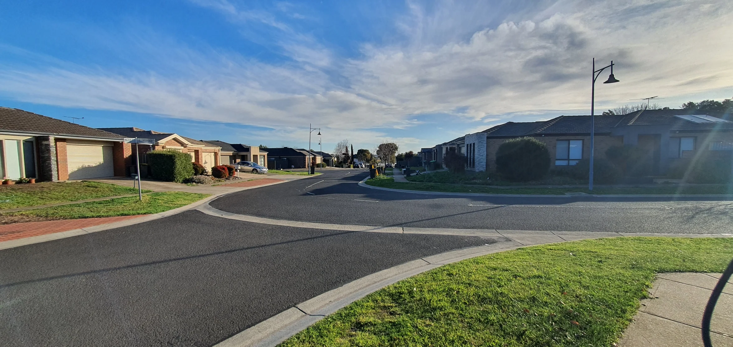
The 10-minute model is not impossible. It requires higher residential density (currently 13 persons/hectare, below the city's own 16-dwelling target), dispersed mixed-use development, expanded public transport, and pedestrian infrastructure. This study argues for that model, and maps what it would take.
(target: 16)
private vehicles
CBD commute
for peripheral residents
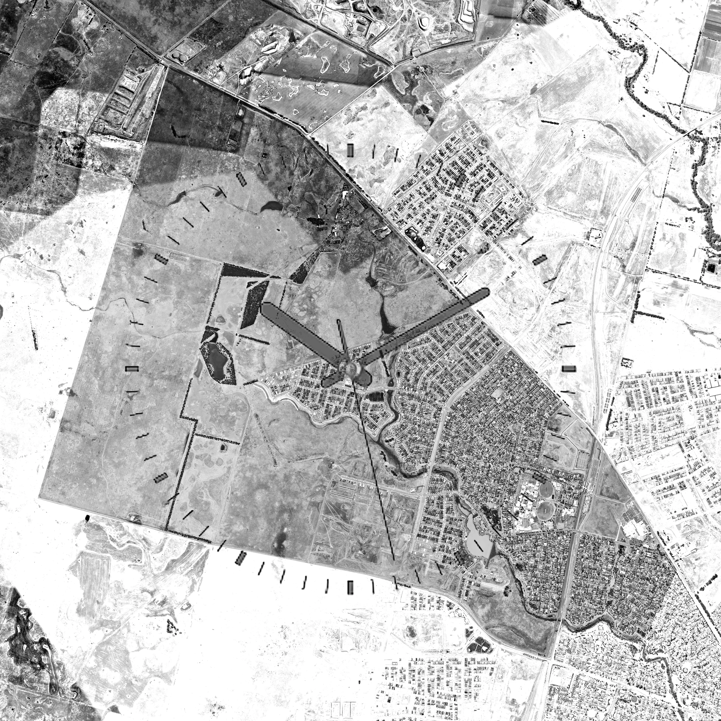
Finding Manor Lakes
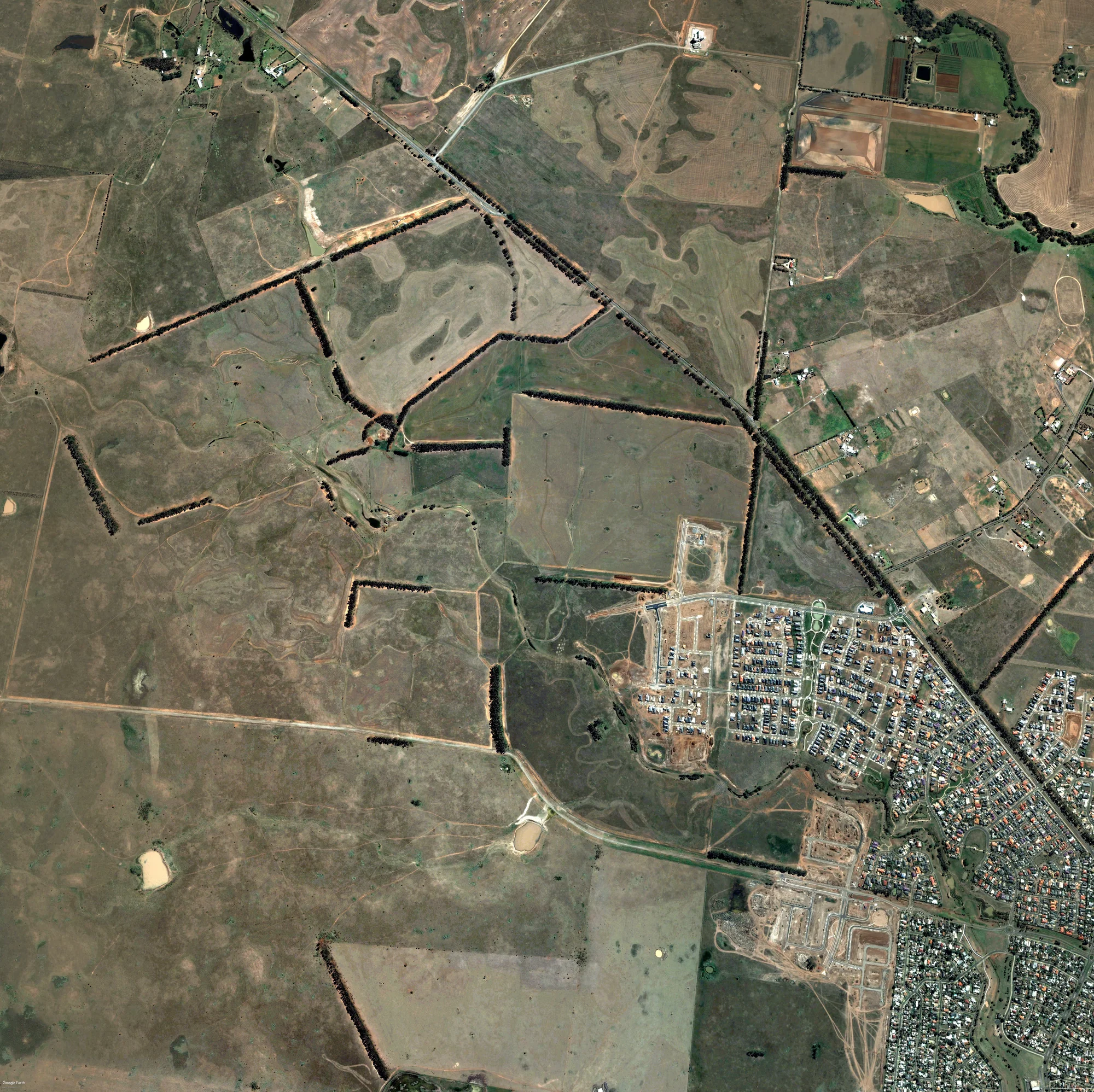
Satellite Chronology
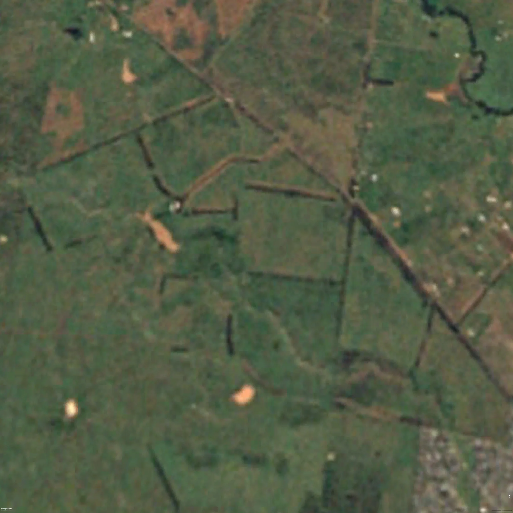 1985
1985
 2004
2004
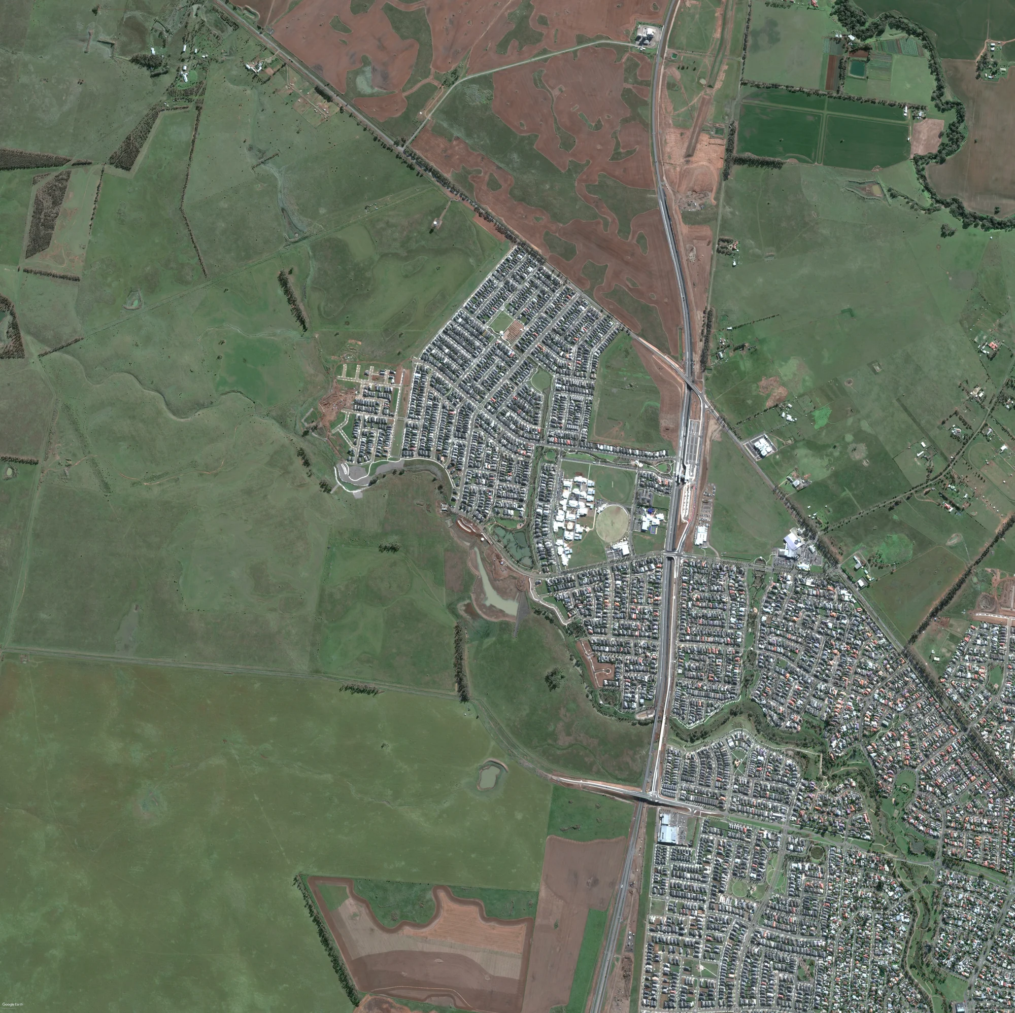 2014
2014
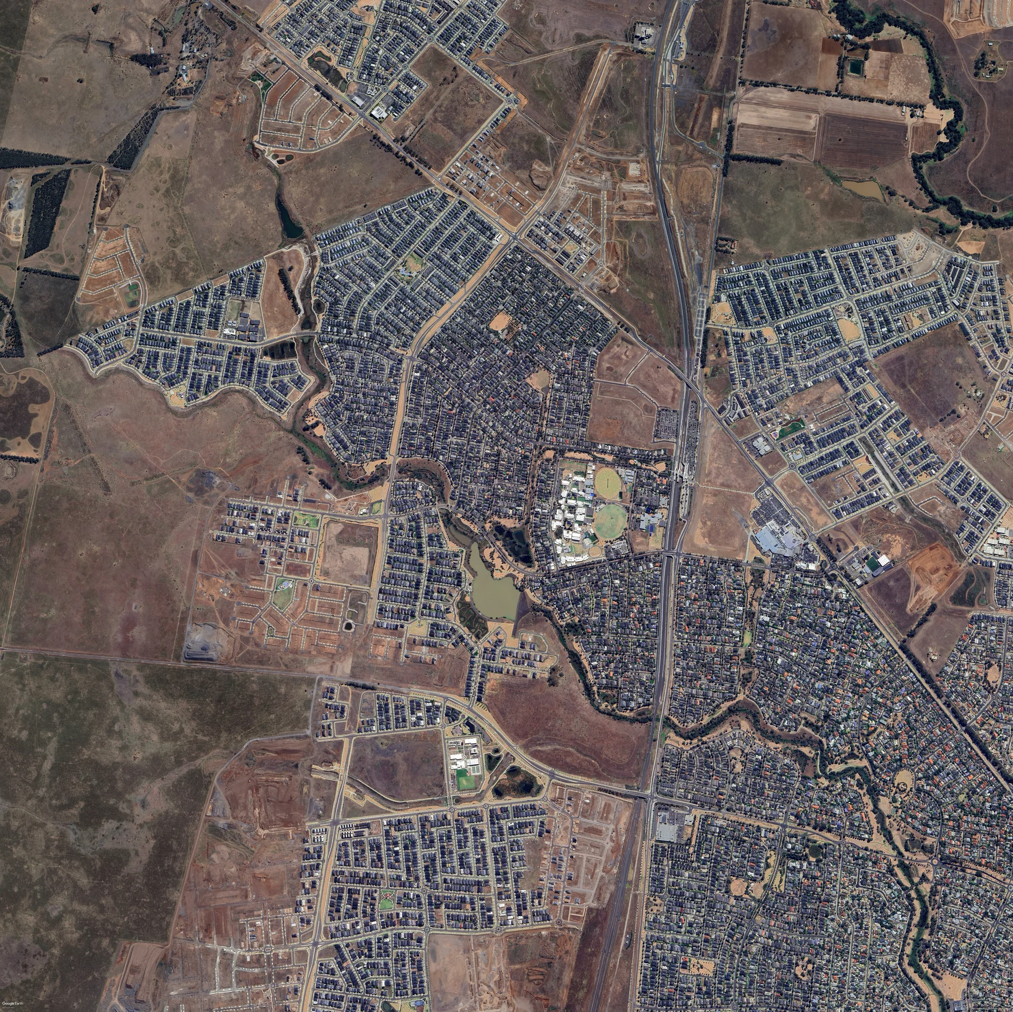 2024
2024
Site Map
The Argument
Melbourne has officially adopted the 20-minute neighbourhood model. In Manor Lakes, this model is structurally undermined by low density, centralised amenity distribution, and a single-mode transport network. The 20-minute model improves on traditional suburban planning, but not enough.
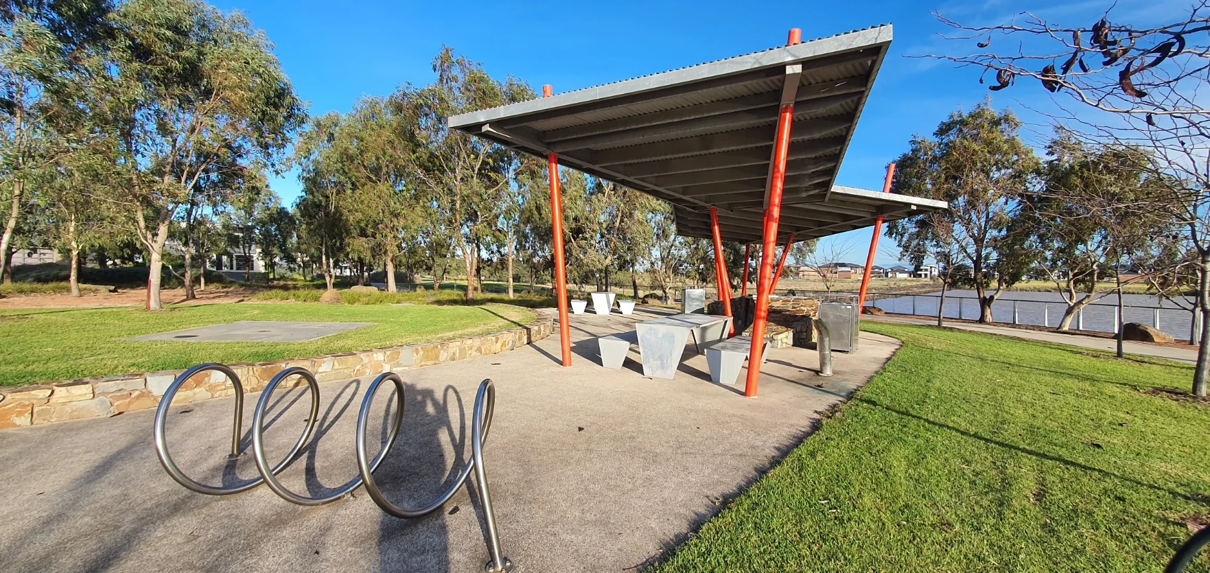
The 10-minute model requires: higher-density housing (townhouses, low-rise apartments) distributed across the suburb rather than concentrated at the town centre; mixed-use development with commercial, retail, and recreational uses embedded in residential fabric; expanded bus routes with higher frequency; potential light rail connection; pedestrian and cycling infrastructure throughout.
The benefits are quantifiable: improved health outcomes through active transport, reduced greenhouse gas emissions, stronger community social networks, local economic stimulus through foot traffic. Manor Lakes could be a blueprint for the 30+ other outer suburbs facing identical conditions.
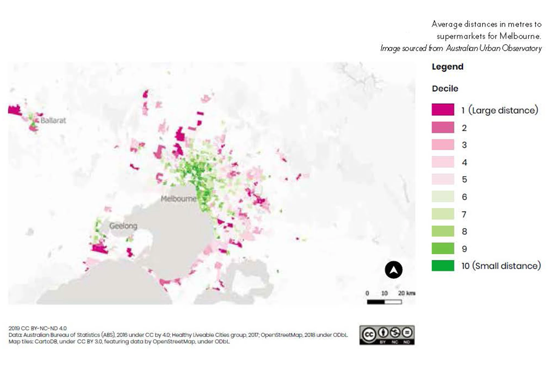
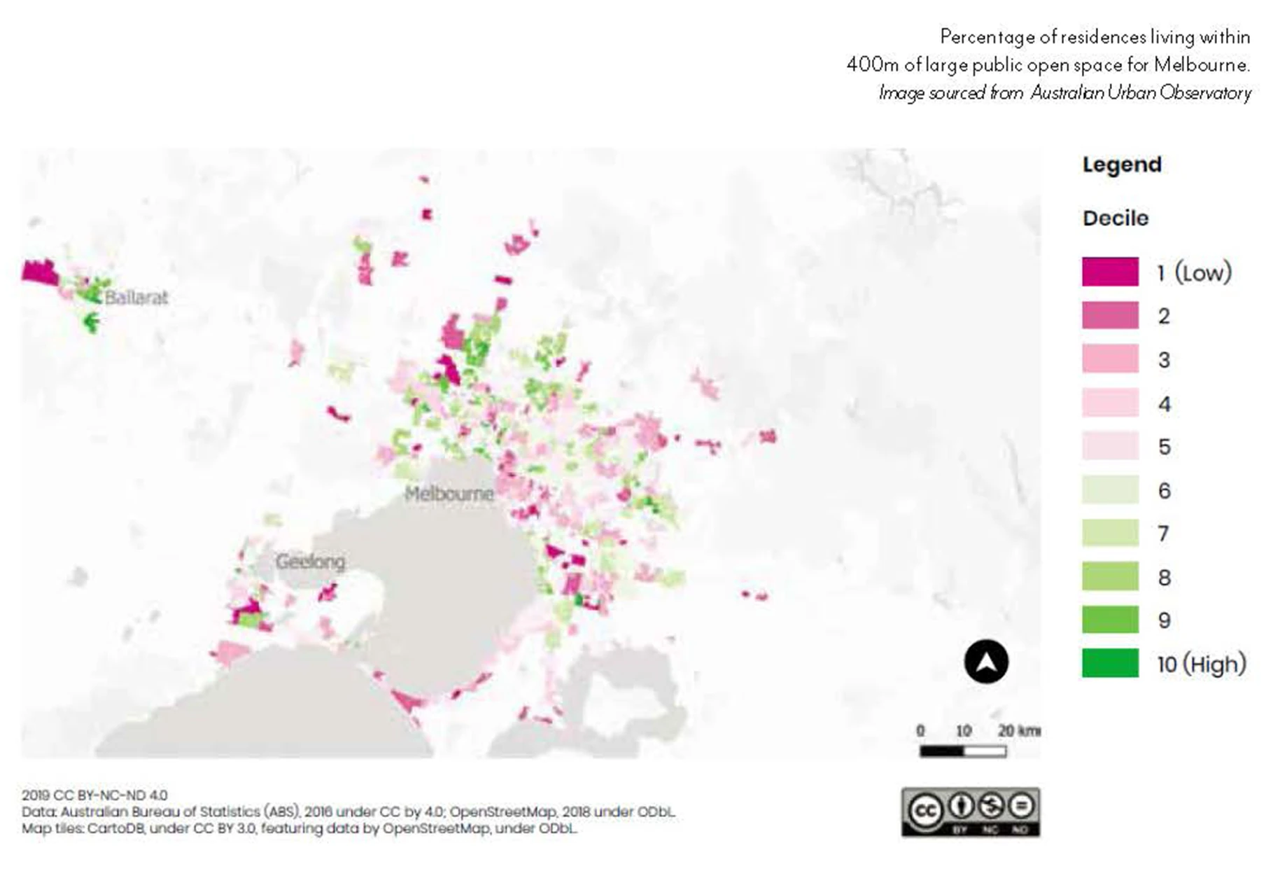
GIS Analysis
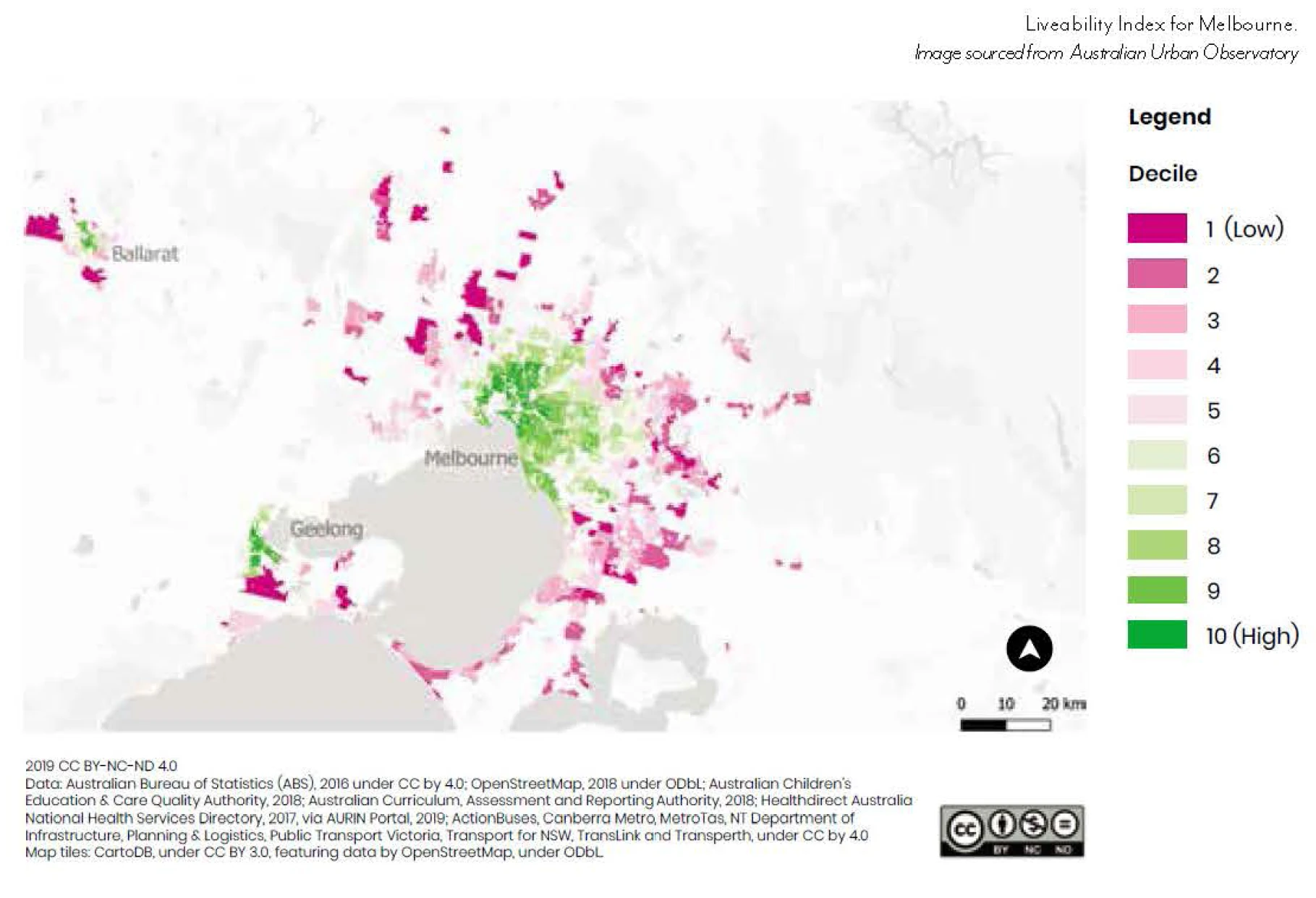
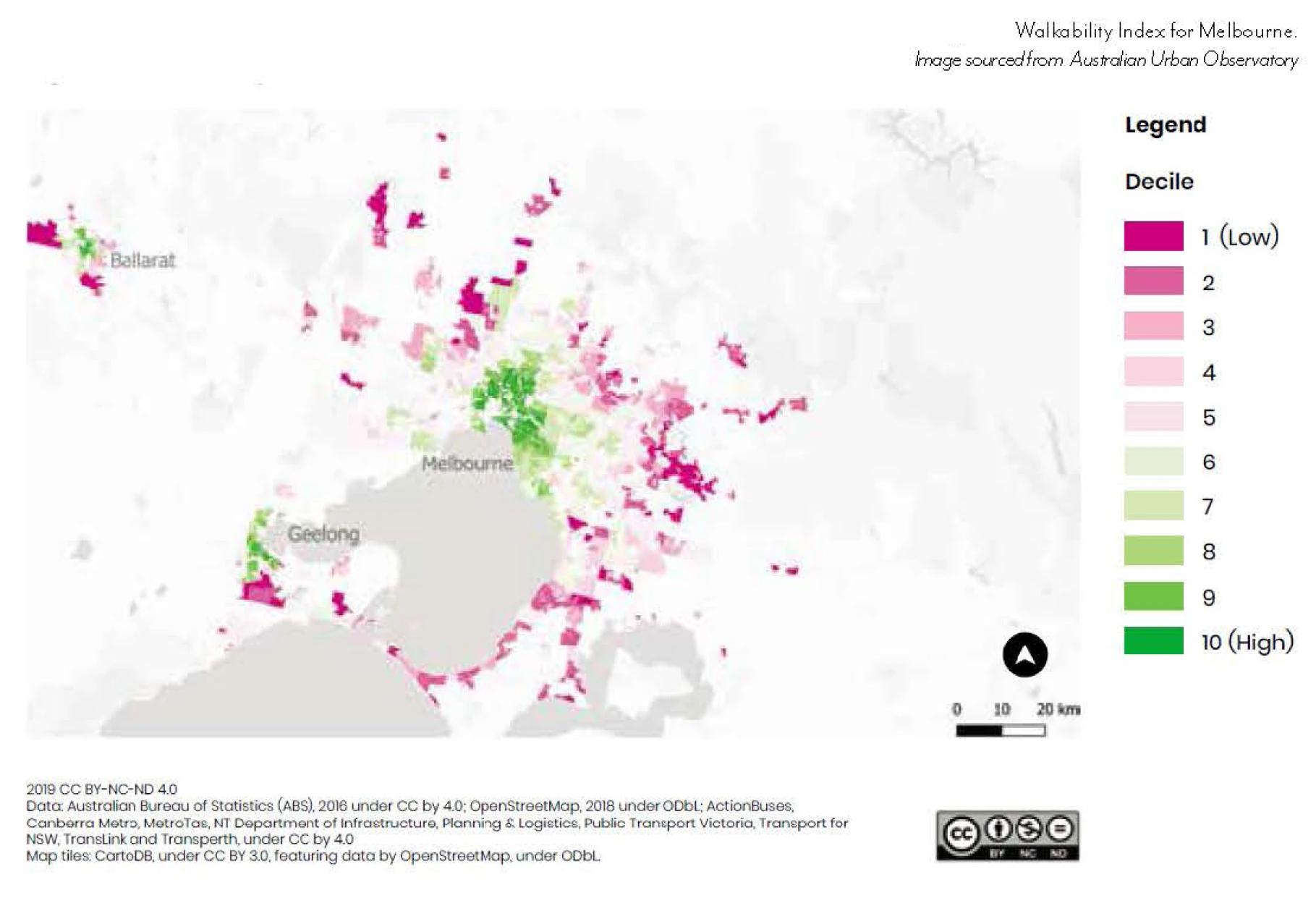
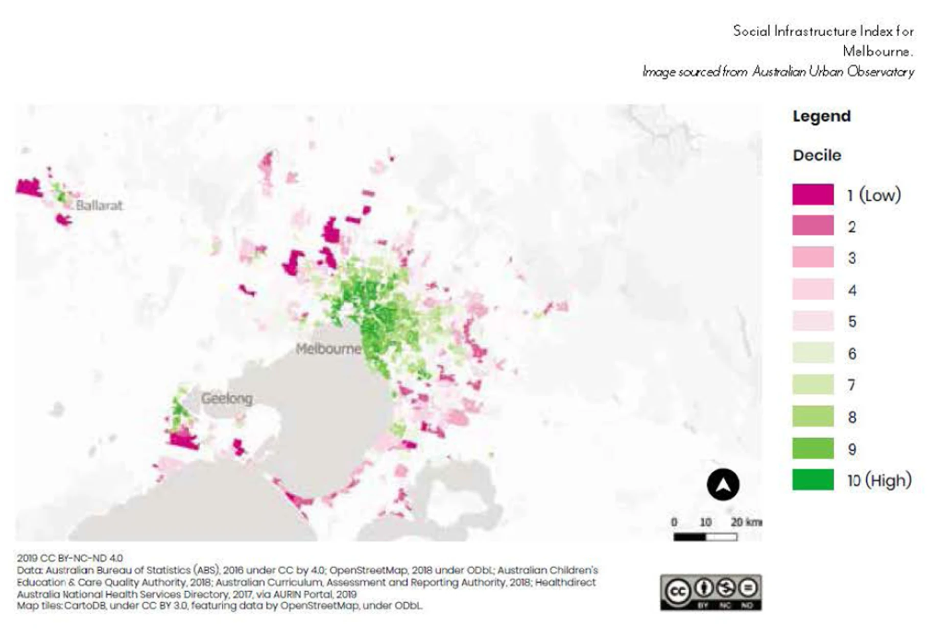
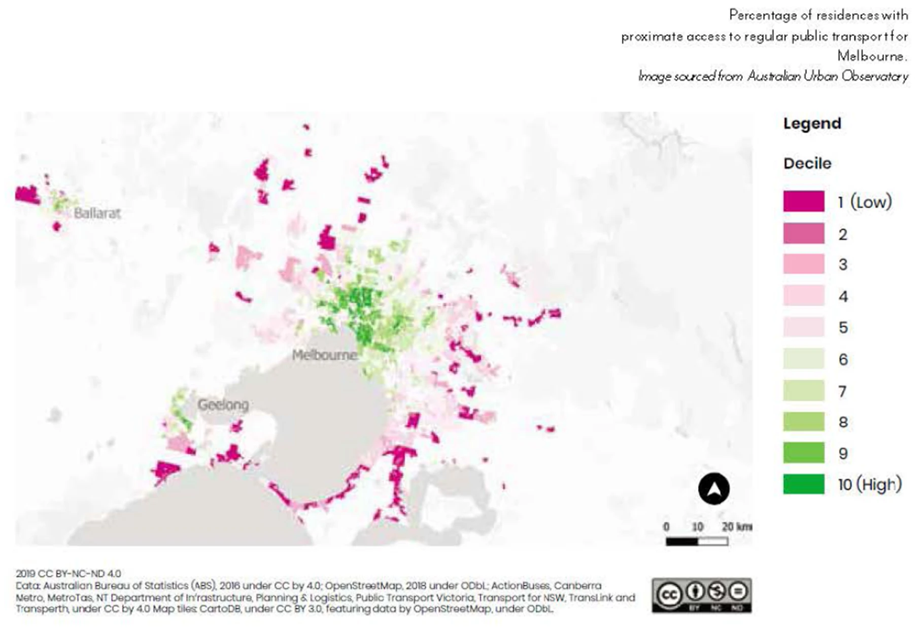
Liveability Scores
Sections
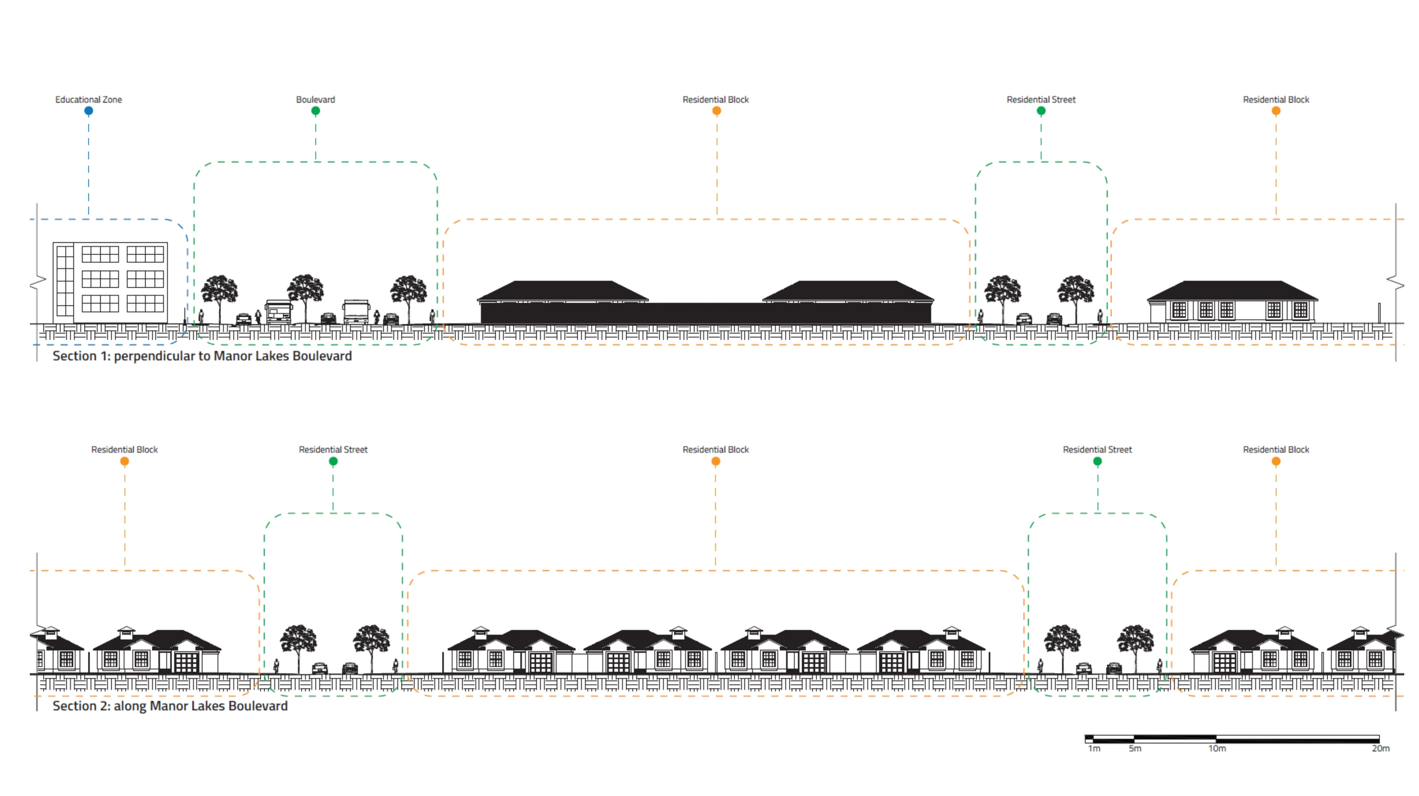 Existing: Sections perpendicular to and along Manor Lakes Boulevard
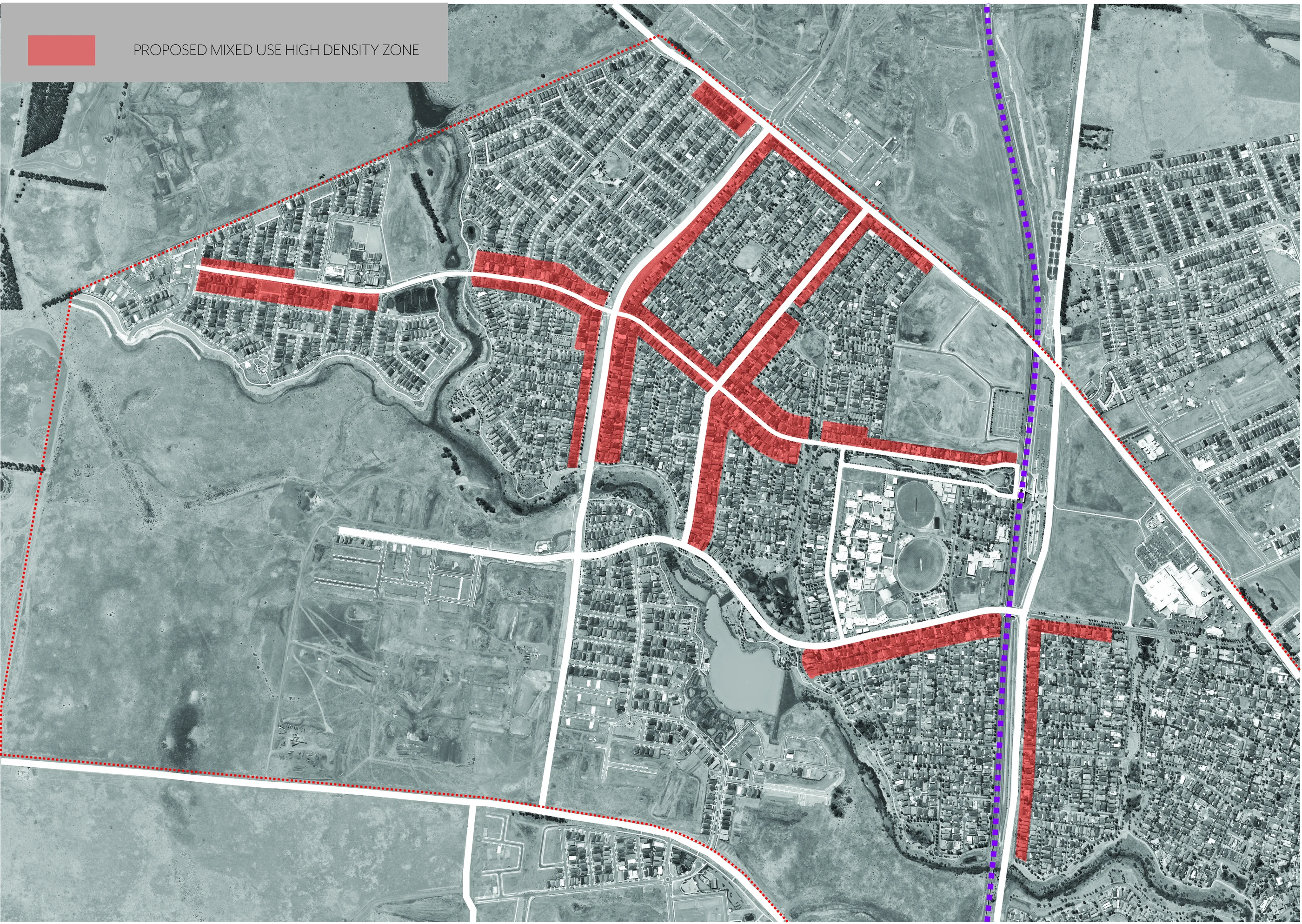
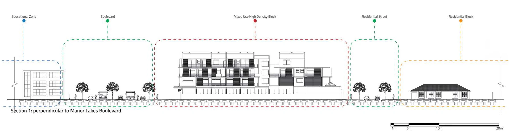 Proposed: Mixed-use high density replacing low-density residential
Proposed Masterplan
Research Paper
Theoretical Framework
Chrono-Urbanism + the X-Minute City
Logan, T.M. et al. "The X-Minute City: Measuring the 10, 15, 20-Minute City and an Evaluation of Its Use for Sustainable Urban Design." Cities 131 (2022). Capasso Da Silva, D., King, D.A. & Lemar, S. "Accessibility in Practice: 20-Minute City as a Sustainability Planning Goal." Sustainability 12, no. 1 (2019). Di Marino, M. et al. "The 15-Minute City Concept and New Working Spaces: A Planning Perspective from Oslo and Lisbon." European Planning Studies 31, no. 3 (2023). Kesarovski, T. & Hernández-Palacio, F. "Time, the Other Dimension of Urban Form: Measuring the Relationship between Urban Density and Accessibility to Grocery Shops in the 10-Minute City." Environment and Planning B 50, no. 1 (2023). Department of Transport and Planning, Victoria. "20-Minute Neighbourhoods." (2024).
Liveability, Density + Urban Form
Wiryomartono, B. Livability and Sustainability of Urbanism: An Interdisciplinary Study on History and Theory of Urban Settlement. Springer (2020). Martino, N., Girling, C. & Lu, Y. "Urban Form and Livability: Socioeconomic and Built Environment Indicators." Buildings and Cities 2, no. 1 (2021). Morley, M. & Pafka, E. "'Density Done Well' in the Pursuit of 20-Minute Neighbourhoods: Navigating Fluid Discourses in Melbourne." Urban Policy and Research 41, no. 2 (2023). Hodyl, L. "To Investigate Planning Policies That Deliver Positive Social Outcomes in Hyper-Dense, High-Rise Residential Environments." Churchill Fellowship Report (2015). Victorian Competition and Efficiency Commission. "A State of Liveability: An Inquiry into Enhancing Victoria's Liveability." (2008). RMIT University Centre for Urban Research. "Liveability Report for Melbourne."
Health, Transport + Active Mobility
Giles-Corti, B. et al. "City Planning and Population Health: A Global Challenge." The Lancet 388, no. 10062 (2016). Giles-Corti, B., Ryan, K. & Foster, S. "Increasing Density in Australia: Maximising the Health Benefits and Minimising Harm." National Heart Foundation (2012). Idziorek, K. & Zuñiga, M.E. "Achieving 10-Min Neighborhoods in Underinvested Communities: Understanding Transportation Opportunities and Challenges through Resident Stories." Transportation Research Record (2024). Dodson, J. "In the Wrong Place at the Wrong Time? Assessing Some Planning, Transport and Housing Market Limits to Urban Consolidation Policies." Urban Policy and Research 28, no. 4 (2010).
Policy, Planning + Regulatory Frameworks
Infrastructure Victoria. "Choosing Victoria's Future: Five Urban Development Scenarios." (2023). Growth Areas Authority. "Manor Lakes: Precinct Structure Plan." (2012). Growth Areas Authority. "Manor Lakes: Development Contributions Plan." (2012). Victoria State Government. "Understanding the Residential Development Standards (ResCode): Planning Practice Note 27." (2024). Victoria State Government. "Urban Design Frameworks: Planning Practice Note 17." (2015). SGS Economics and Planning. "Residential Growth Management Strategy." Wyndham City (2016).
Community Resistance + Social Sustainability
Trounstine, J. "You Won't Be My Neighbor: Opposition to High Density Development." Urban Affairs Review 59, no. 1 (2023). Dockery, M. et al. "How Many in a Crowd? Assessing Overcrowding Measures in Australian Housing." (2022). Giles-Corti, B., Rozek, J. & Gunn, L. "The World's 'Most Liveable City' Title Isn't a Measure of the Things Most of Us Actually Care About." The Conversation (2018). Gurran, N. et al. "New Directions in Planning for Affordable Housing: Australian and International Evidence and Implications."
Data Sources
Australian Bureau of Statistics. "2021 Manor Lakes, Census All Persons QuickStats." Wyndham City Council. "2021 Manor Lakes Suburb Infographic." Wyndham City Council. "Resilient Wyndham 2021-2025." Australian Urban Observatory (AUO). Liveability and walkability indices. Public Transport Victoria. Manor Lakes service data. Economist Intelligence Unit. "The Global Liveability Index 2023."