Major Project · RMIT · Semester 2, 2025
Stateless Architecture:
A Bandage Blueprint
Stateless Architecture investigates how architecture might operate as a medium of repair within a confined, self-evolved urban organism. Through site-based spatial analysis and typological mapping, the project reimagines the camp's ad-hoc structures as a framework for participatory transformation rather than complete demolition or total displacement.
Geneva Camp, Mohammadpur, Dhaka. 60,000 square metres. Up to 50,000 Urdu-speaking Biharis. A density of 0.6 million people per square kilometre , approximately 2 square metres per person. The largest of 116 stateless settlements across Bangladesh, and the only one where land remains privately owned.
The design proposes micro-infrastructural interventions, incremental housing prototypes, water and sanitation nodes, and shared civic spaces that strengthen the camp's cultural fabric while addressing its infrastructural deficiencies. Three principles structure the intervention: safe structures, accessible sanitation, communal space. The thesis: from emergency bandage to everyday dignity.
History of Biharis in Bangladesh
Urdu-speaking Muslim migrants from Bihar and nearby North India arrived in East Pakistan in 1947–48, drawn by the promise of a Muslim homeland. Concentrated in urban centres, many took up jobs in jute mills, railways, and municipal services, aligning politically with the Muslim League and West Pakistan's central government. Despite forming the majority population, East Pakistan watched its jute revenues and political agency flow westward across 1,600 km of Indian territory. The Language Movement of 1952, the Six-Point autonomy demands of 1966, and a decade of military rule built a Bengali nationalism the Biharis stood apart from, linguistically and politically.
When the Awami League won Pakistan's 1970 general elections outright and West Pakistan refused to transfer power, Dhaka erupted. On 25 March 1971, the Pakistani army launched Operation Searchlight. Many Biharis, aligned with the Pakistani state, were seen as collaborators with the occupying forces through nine months of liberation war. When the Instrument of Surrender was signed on 16 December 1971 and Bangladesh emerged as an independent state, the reckoning was swift: Biharis were attacked, displaced, and confined to makeshift camps. Most famously: Geneva Camp in Mohammadpur. Pakistan accepted only limited repatriation across the 1970s–1990s, leaving hundreds of thousands effectively stateless. A 2008 High Court ruling recognised citizenship for camp residents born in Bangladesh. Documentation barriers, stigma, and precarious informal work have persisted regardless.
The Site
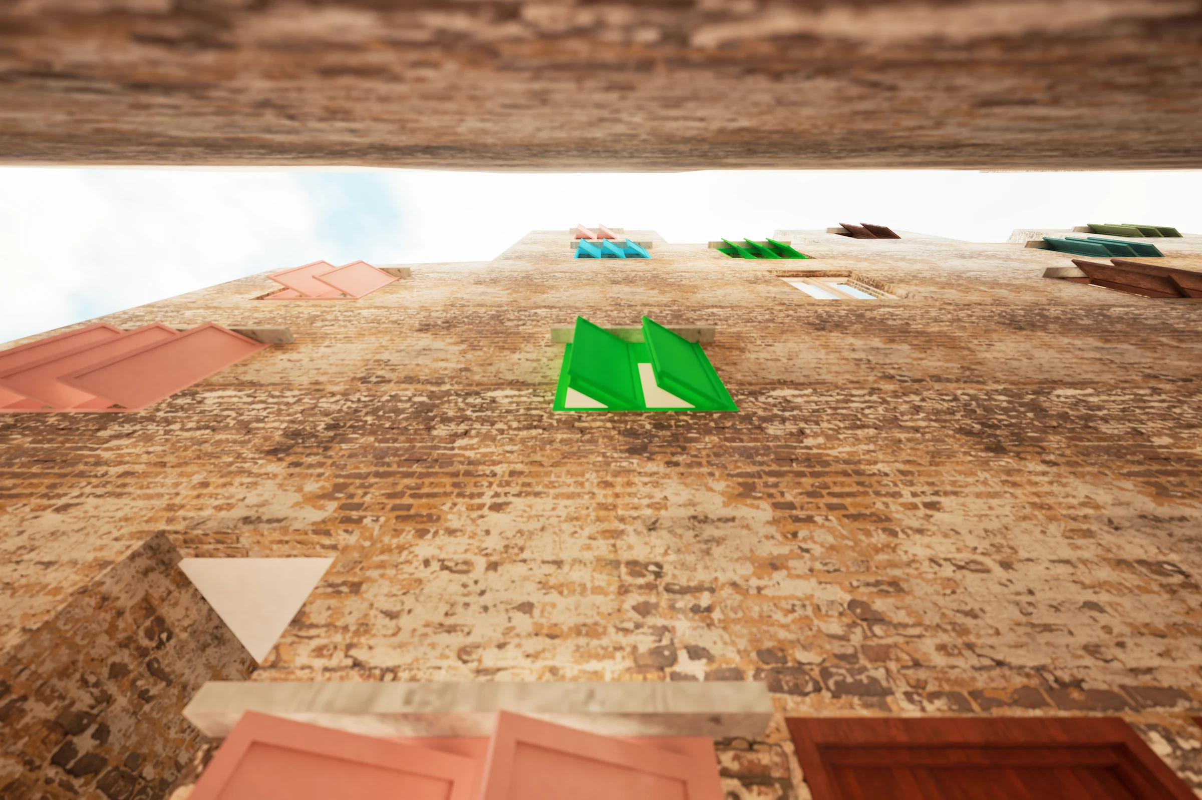
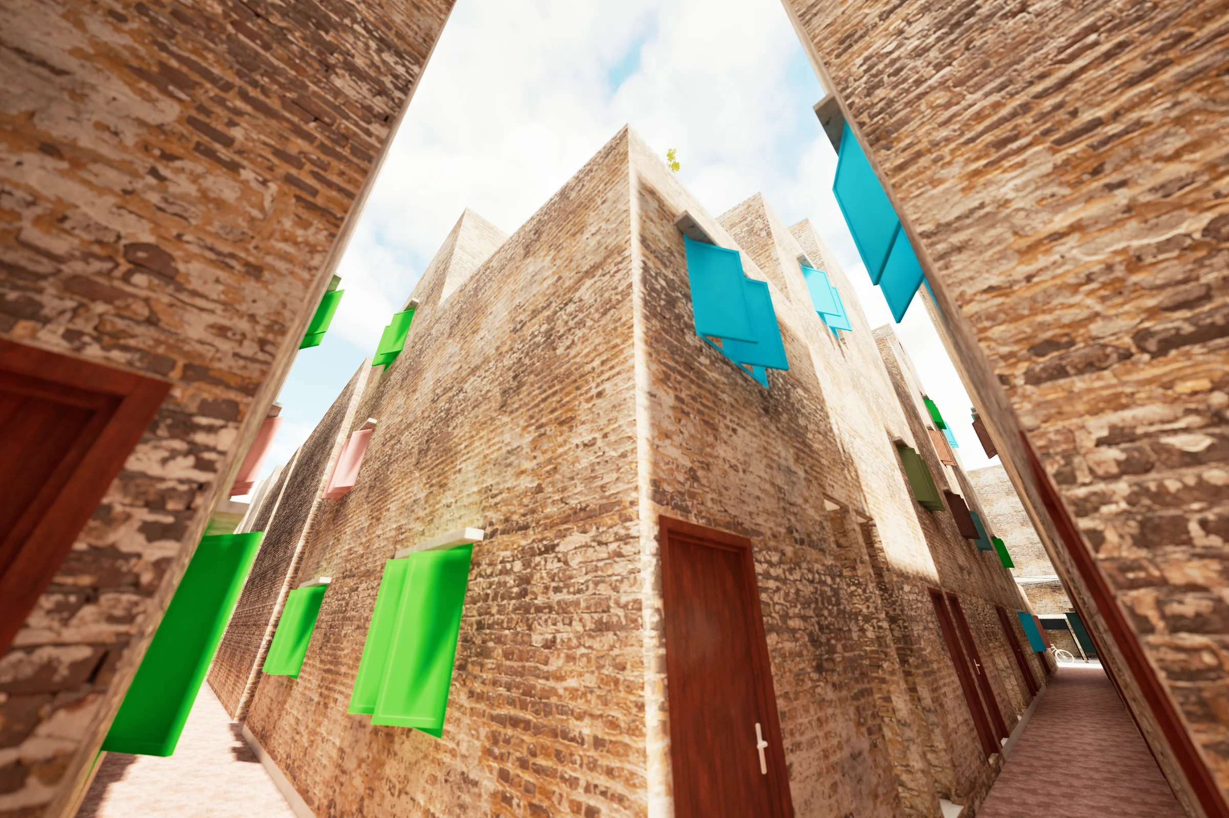
Geneva Camp sits in Mohammadpur, a dense residential thana in western Dhaka. Established in 1972 on land originally intended as temporary shelter, the camp has compacted over five decades into approximately 14 acres of near-continuous built fabric. An estimated 30,000 to 50,000 people occupy a space that would comfortably house a fraction of that number by any urban planning standard.
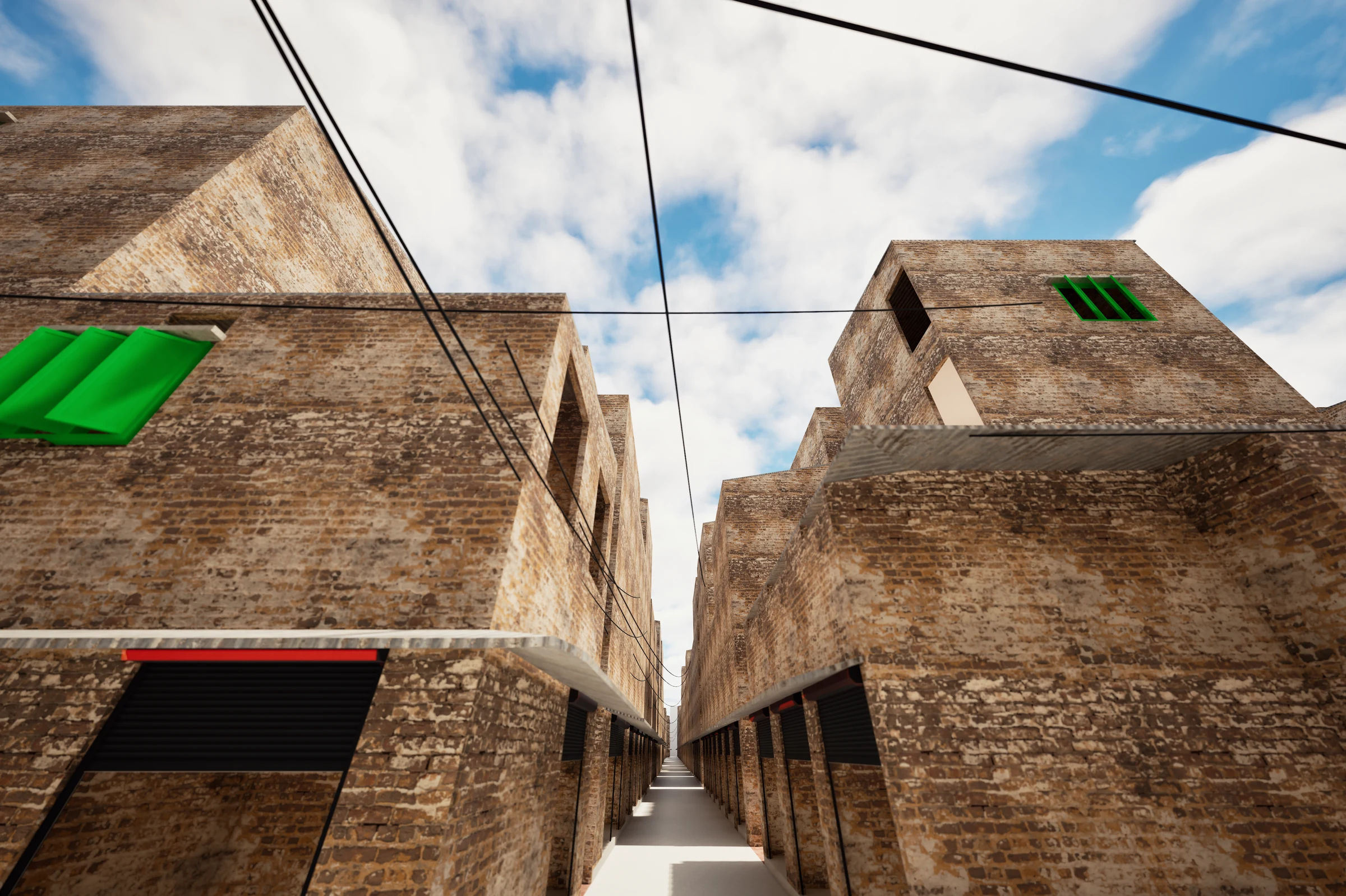
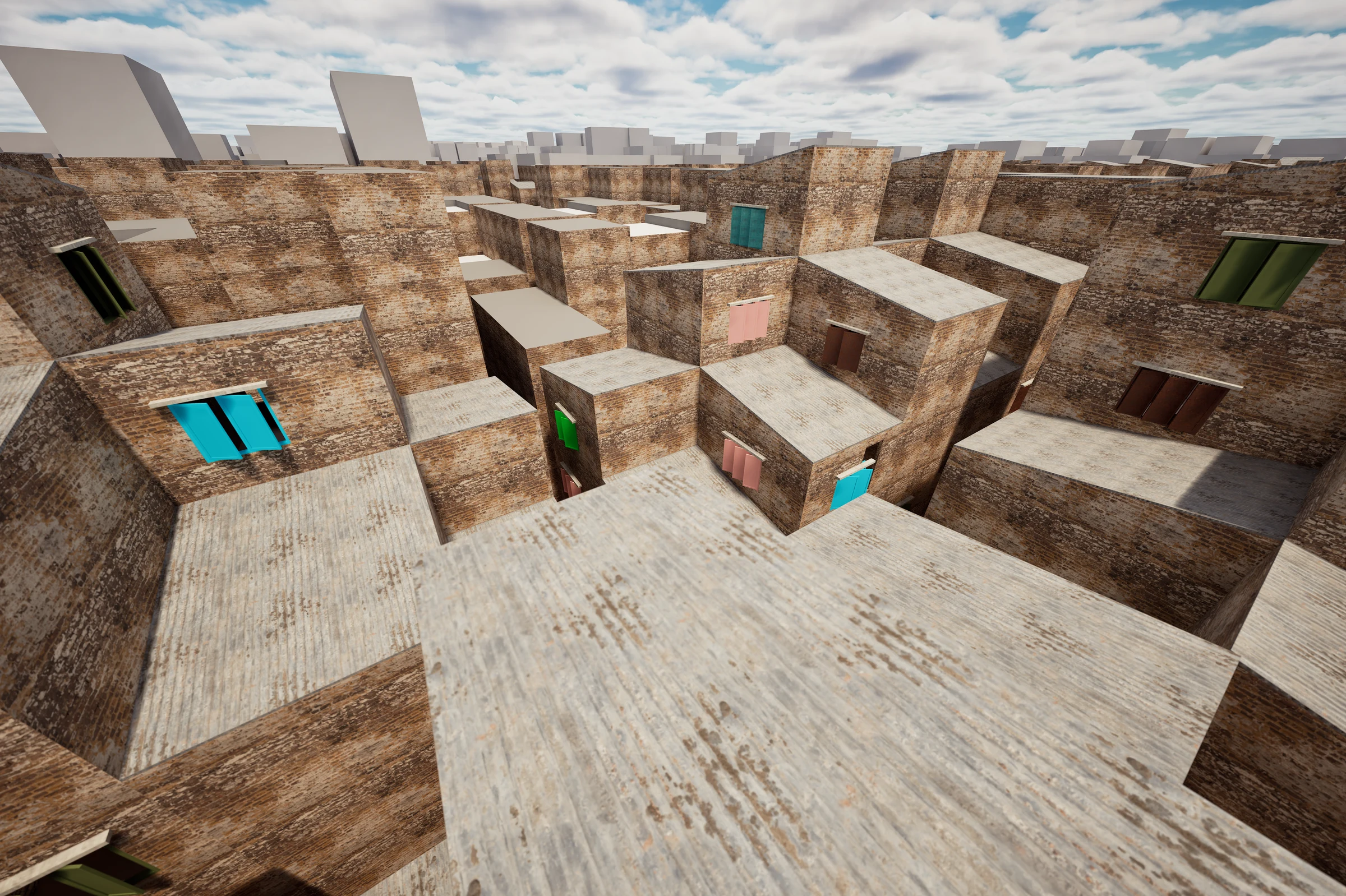
The built form is entirely self-produced. Single-room modules of 6×6 to 10×12 feet were stacked two to four storeys without structural engineering, fire separation, or regulated setbacks. Incremental additions over fifty years have closed every available gap: courtyards infilled, rooftops built over, ground floors converted. Daylight reaches few rooms. Natural ventilation has largely been blocked by adjacent construction. The building stock is structurally compromised in significant portions, with no formal mechanism for inspection or remediation.
A street hierarchy descends from 4-metre lanes at the camp perimeter to 1-metre alleys at the interior. Emergency vehicle access is effectively impossible beyond the edge. 261 communal toilet blocks serve the population: nominally one block per 100 residents, functionally closer to 200, with half in disrepair at any given time. 35 tube wells supply water; only 3 are designated for drinking. There is no interior sewerage network and no septic system. Waste runs through open channels along the alleys. Flooding during monsoon is routine, compounded by subsidence and blocked drainage.
Livelihoods are concentrated in the informal economy: tailoring, small trade, rickshaw pulling, domestic work. Educational attainment is low across generations. Social stigma outside the camp persists despite the 2008 citizenship ruling. The camp is simultaneously a neighbourhood, an economy, a city, and a confinement.
"Stateless Architecture: A Bandage Blueprint: an inquiry into architecture as repair within a confined, self-evolved urban organism. The thesis is simple: from emergency bandage to everyday dignity."Final Presentation, RMIT Major Project, December 2025
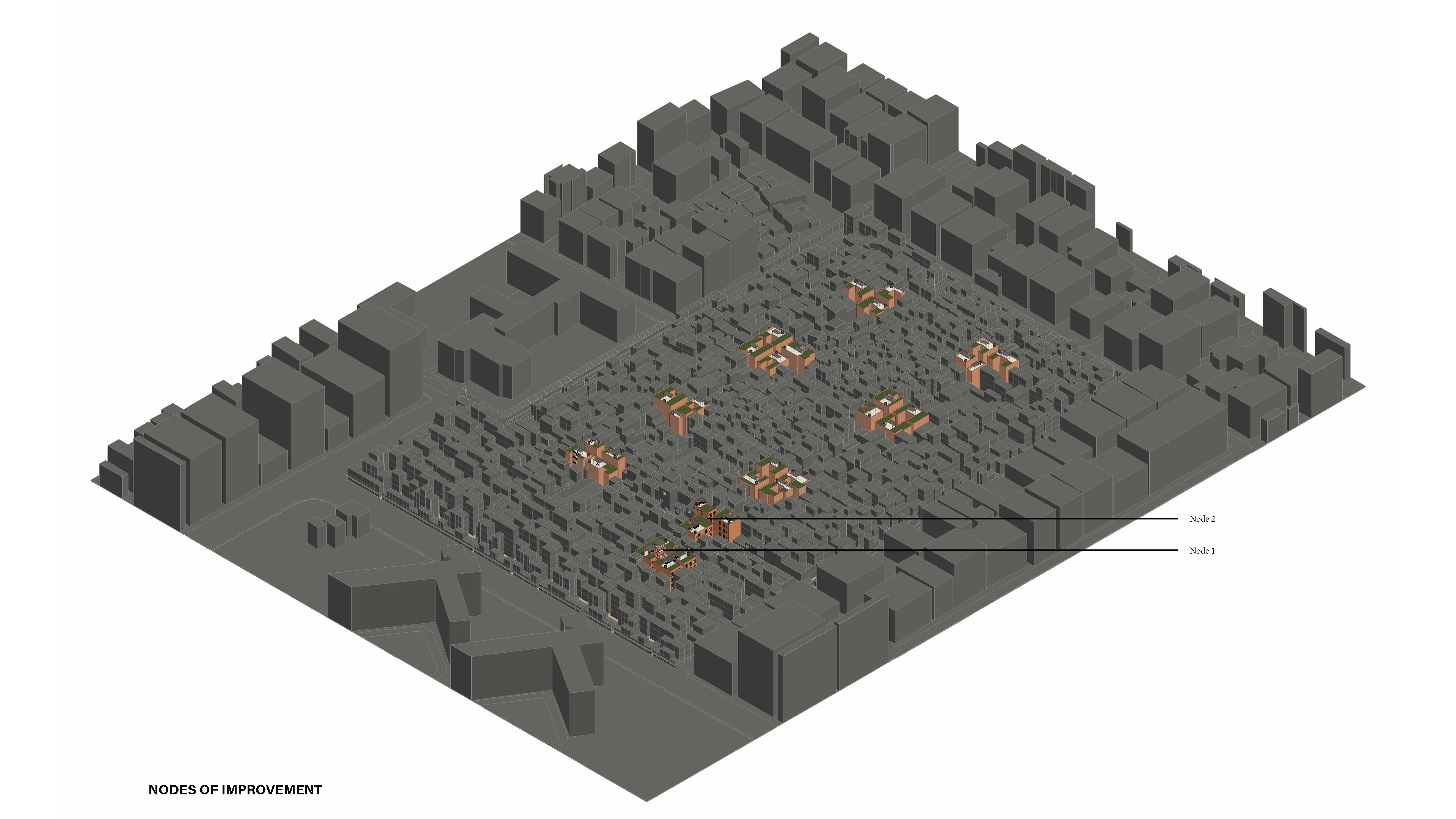
Key Areas of Improvement
The Proposal
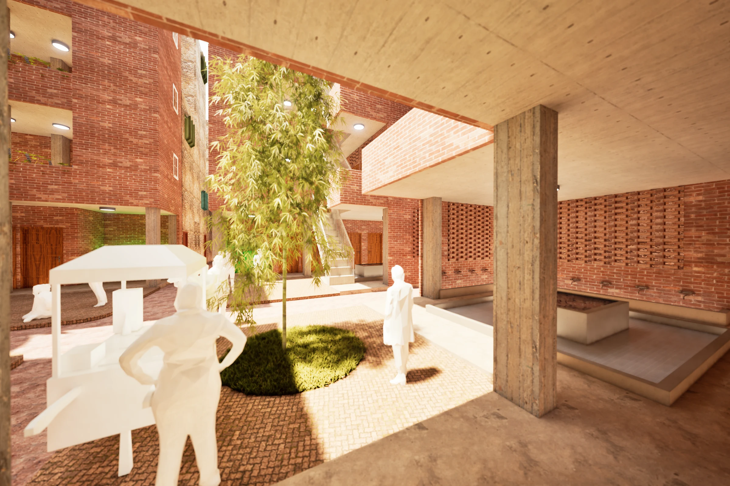
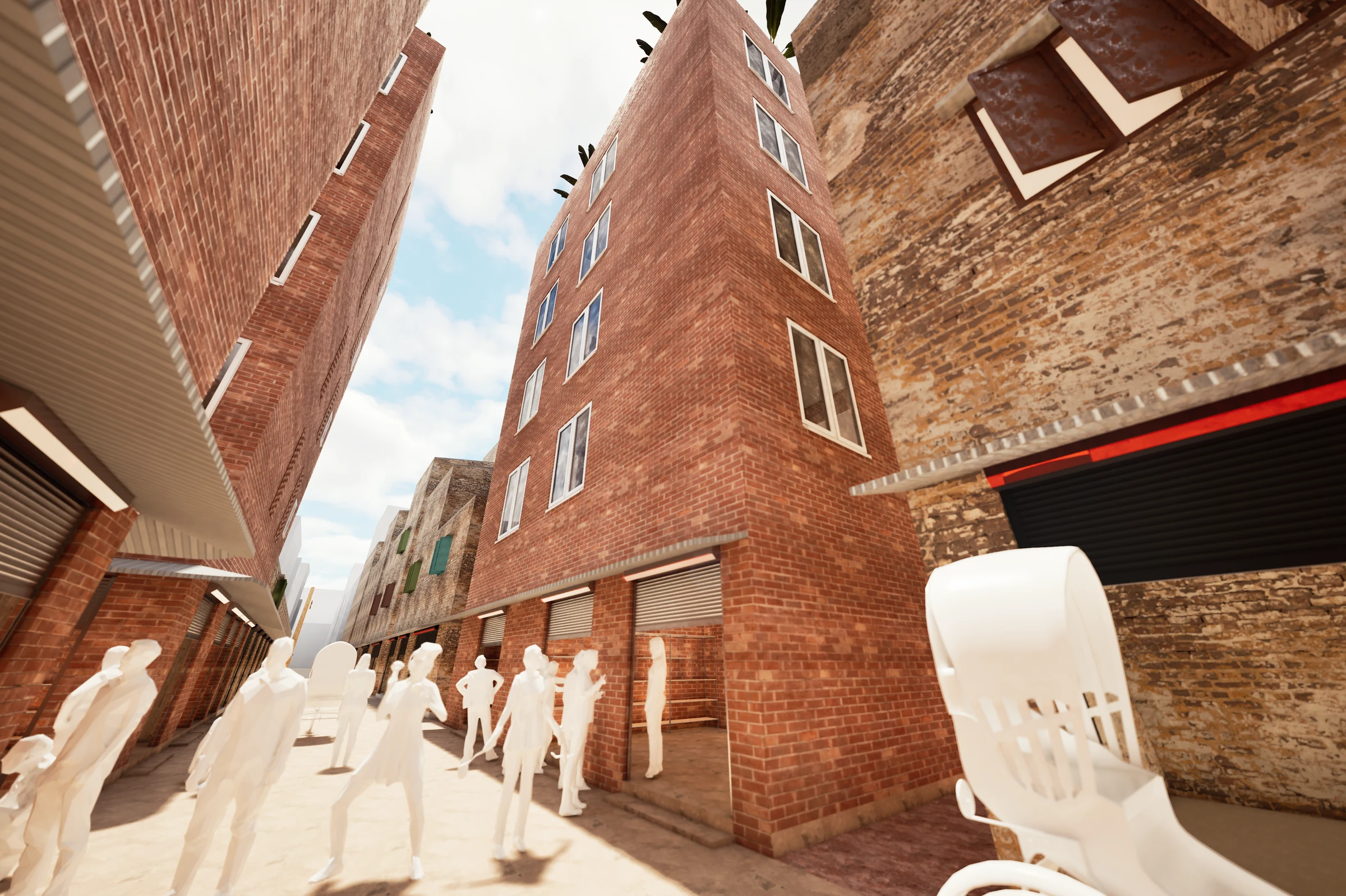
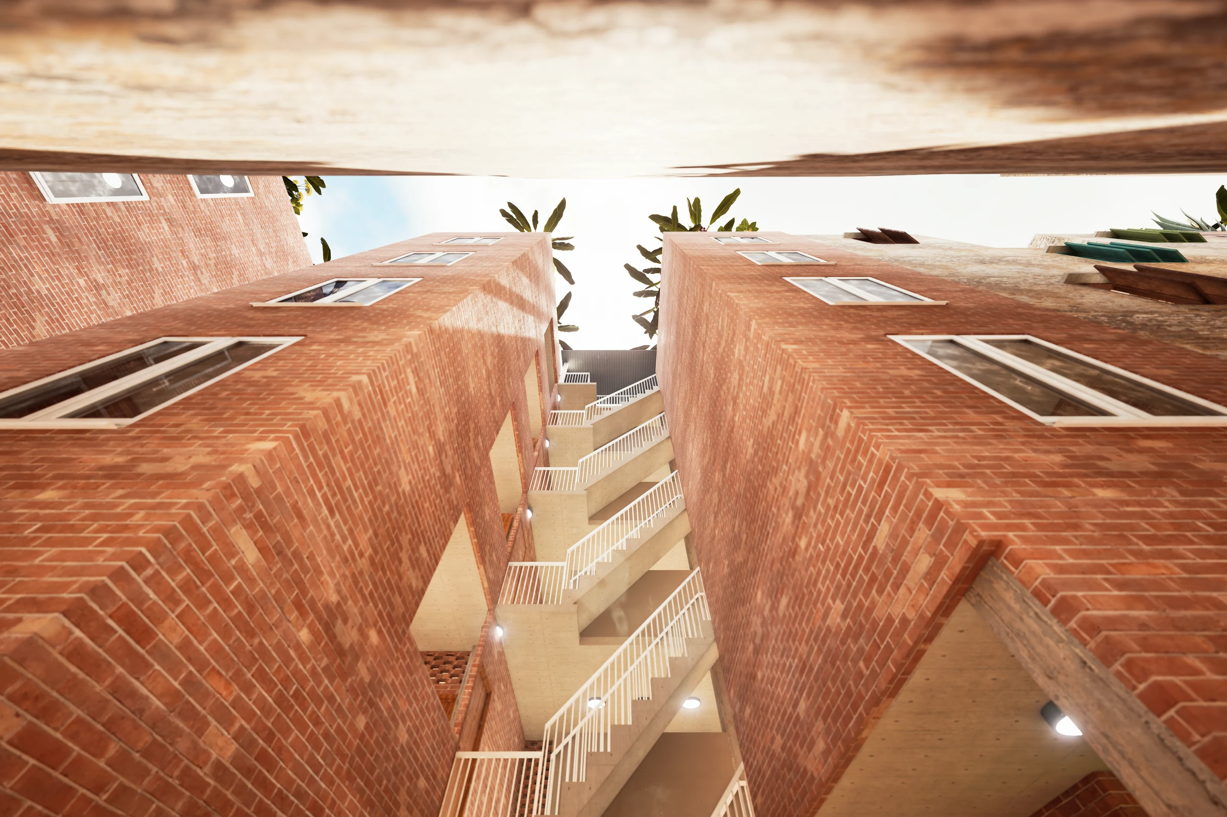
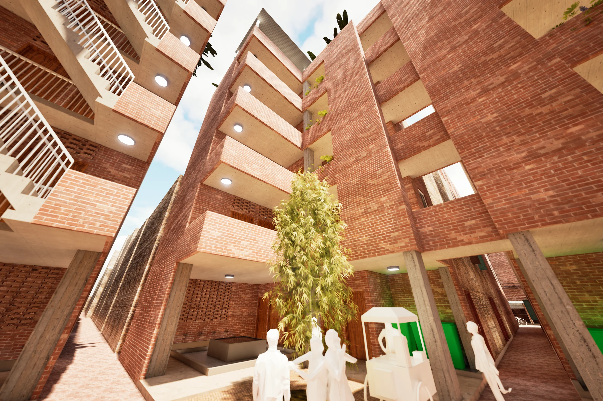
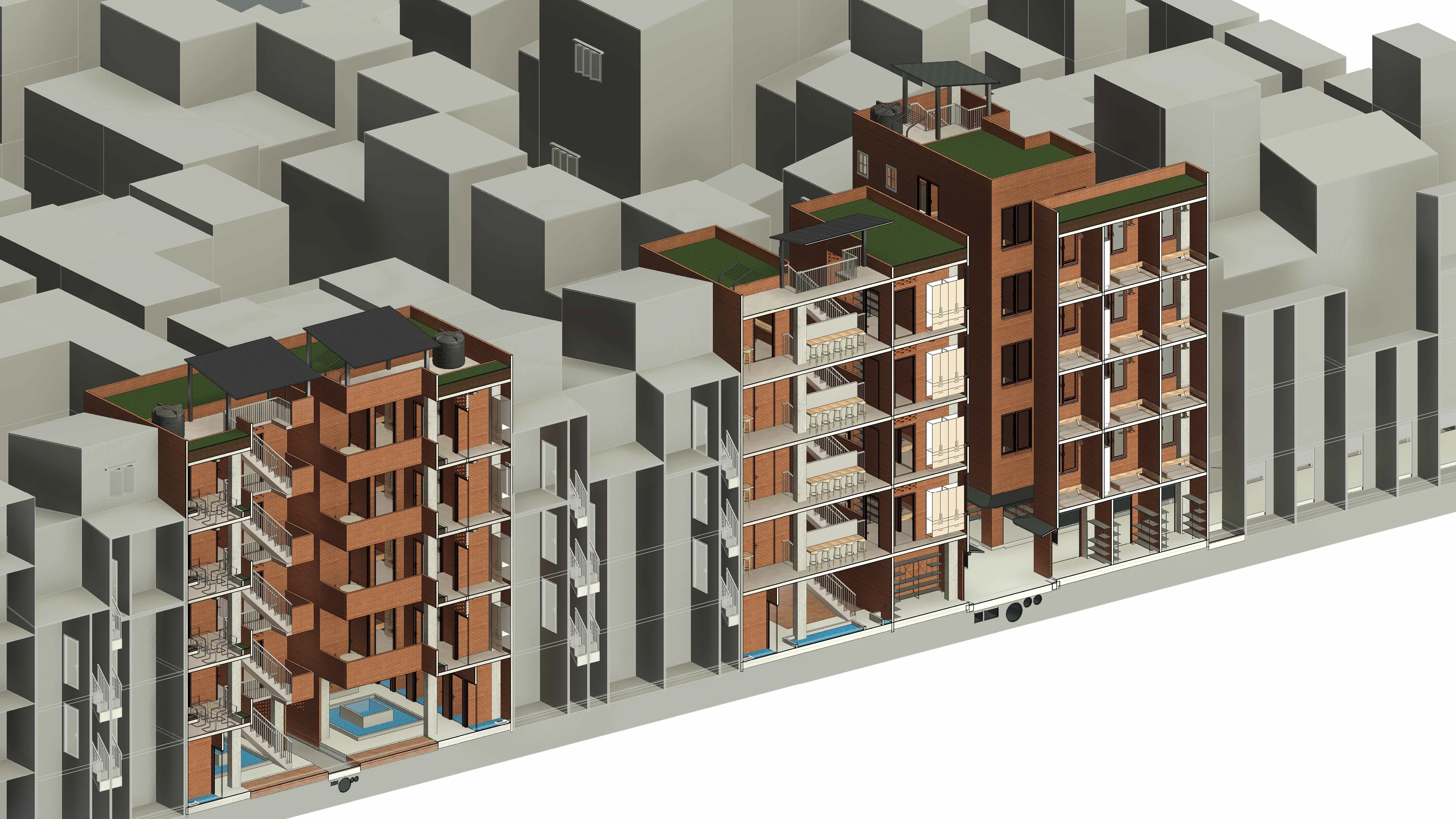
Two node typologies are placed at strategic points within the camp's movement network, replacing the most degraded structures bay by bay. Families temporarily decant to completed bays, then return. No long-distance displacement. The typological reference is the traditional Bangladeshi village uthan : a shared courtyard around which domestic life organises itself.
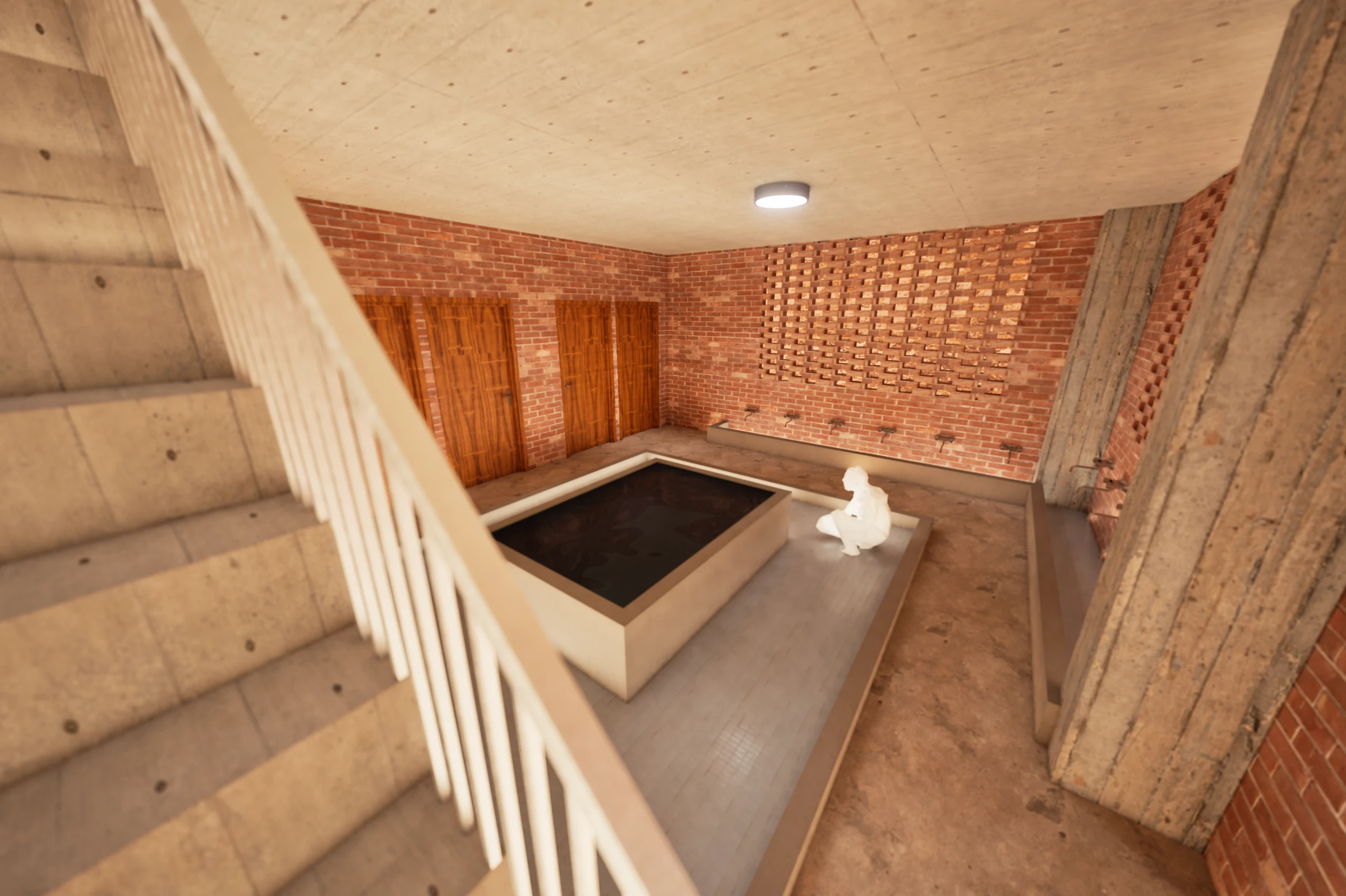
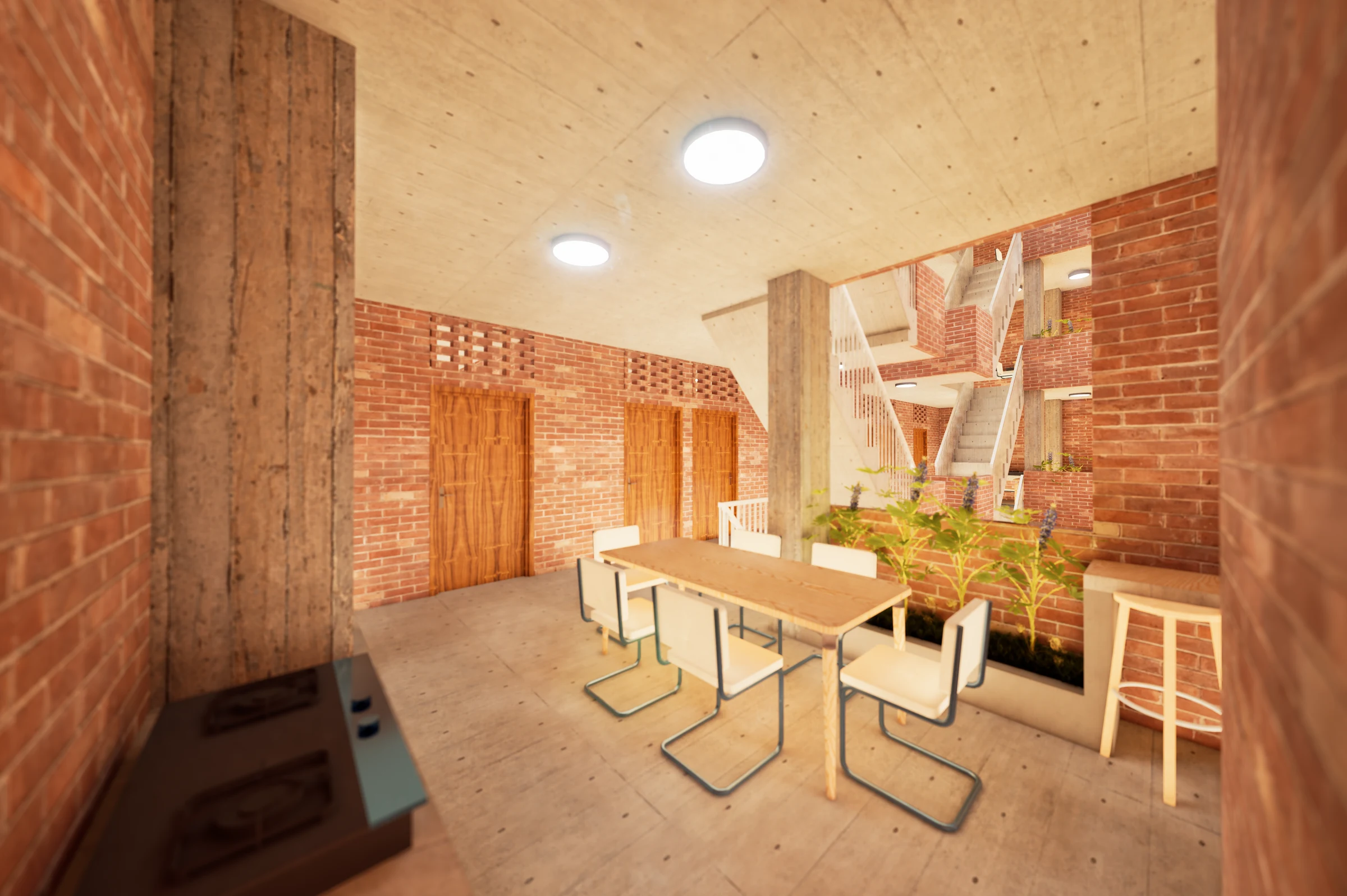
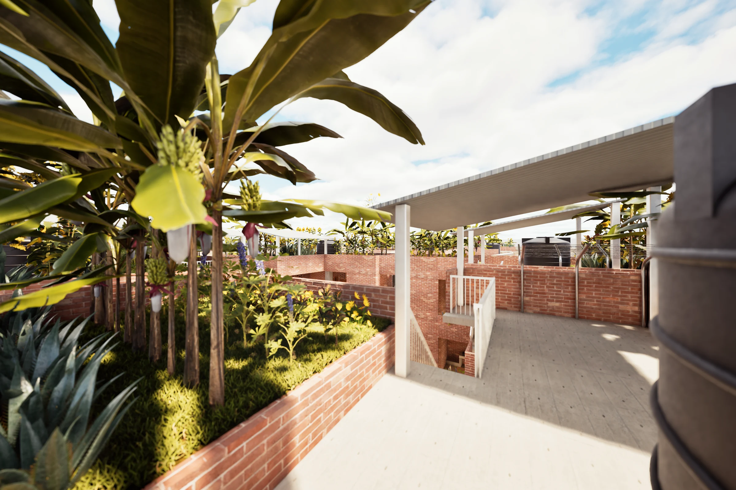
Proposed Node 1: WASH Anchor: Ground level: communal toilet and wash suite, garbage bay, uthan as social spillover. Typical level: common room, shared cooking, flexible living and sleeping. Roof: vegetable garden, rainwater storage.
Proposed Node 2: Livelihood Node: Mirrors the WASH and common stack, with a perimeter shop ribbon: tailoring, repairs, groceries: treating community economies as infrastructure, not afterthought.
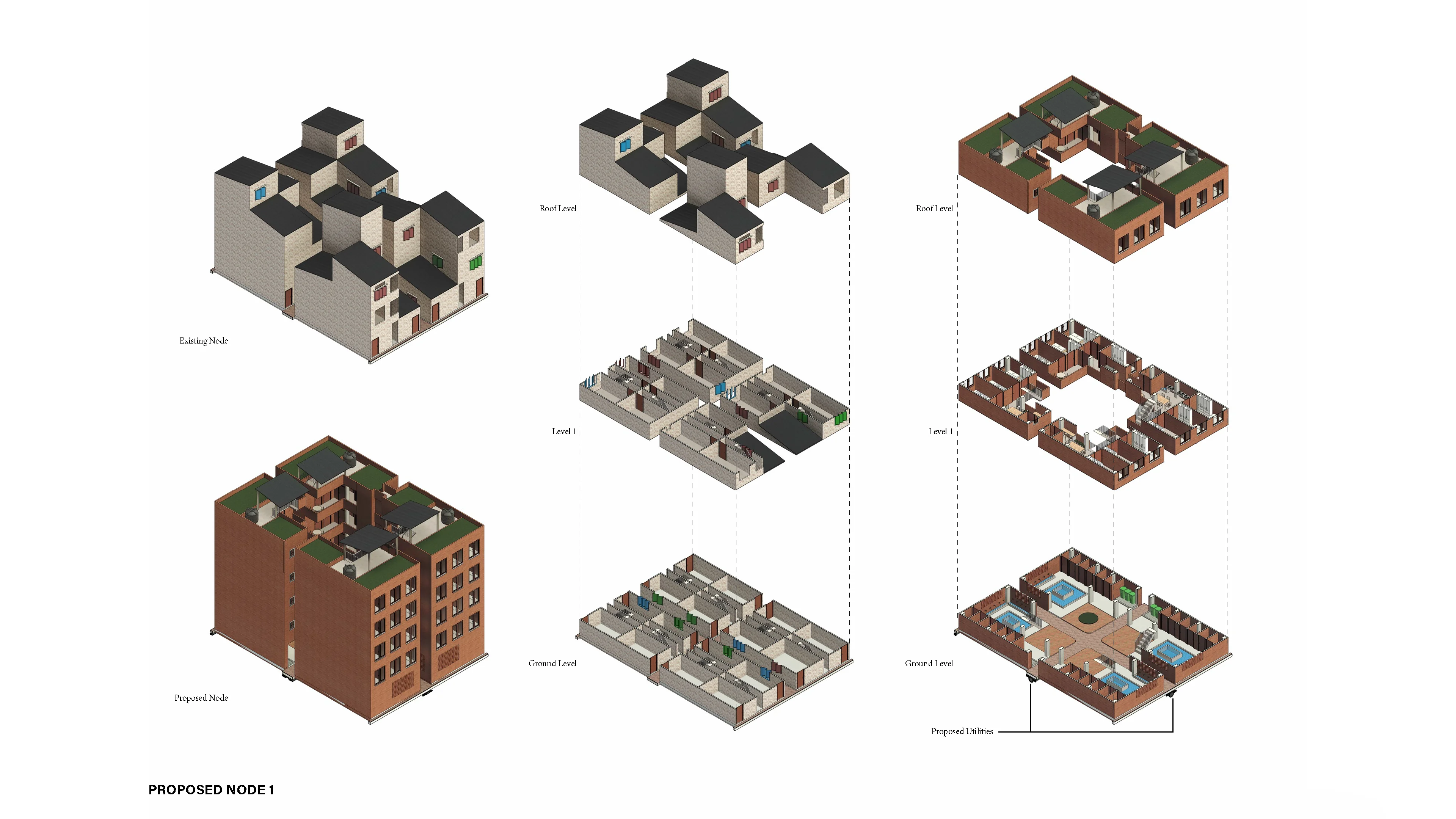
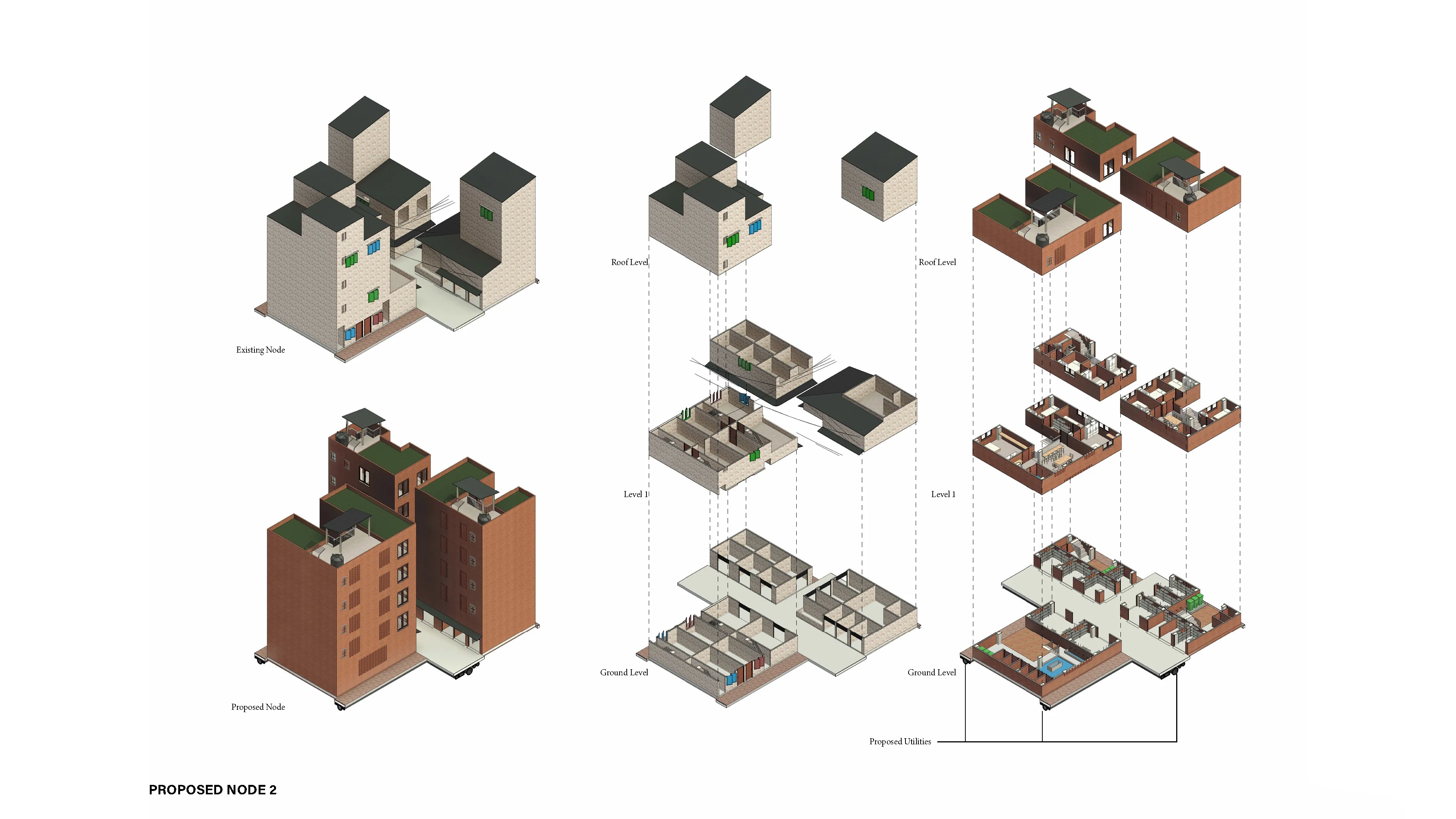
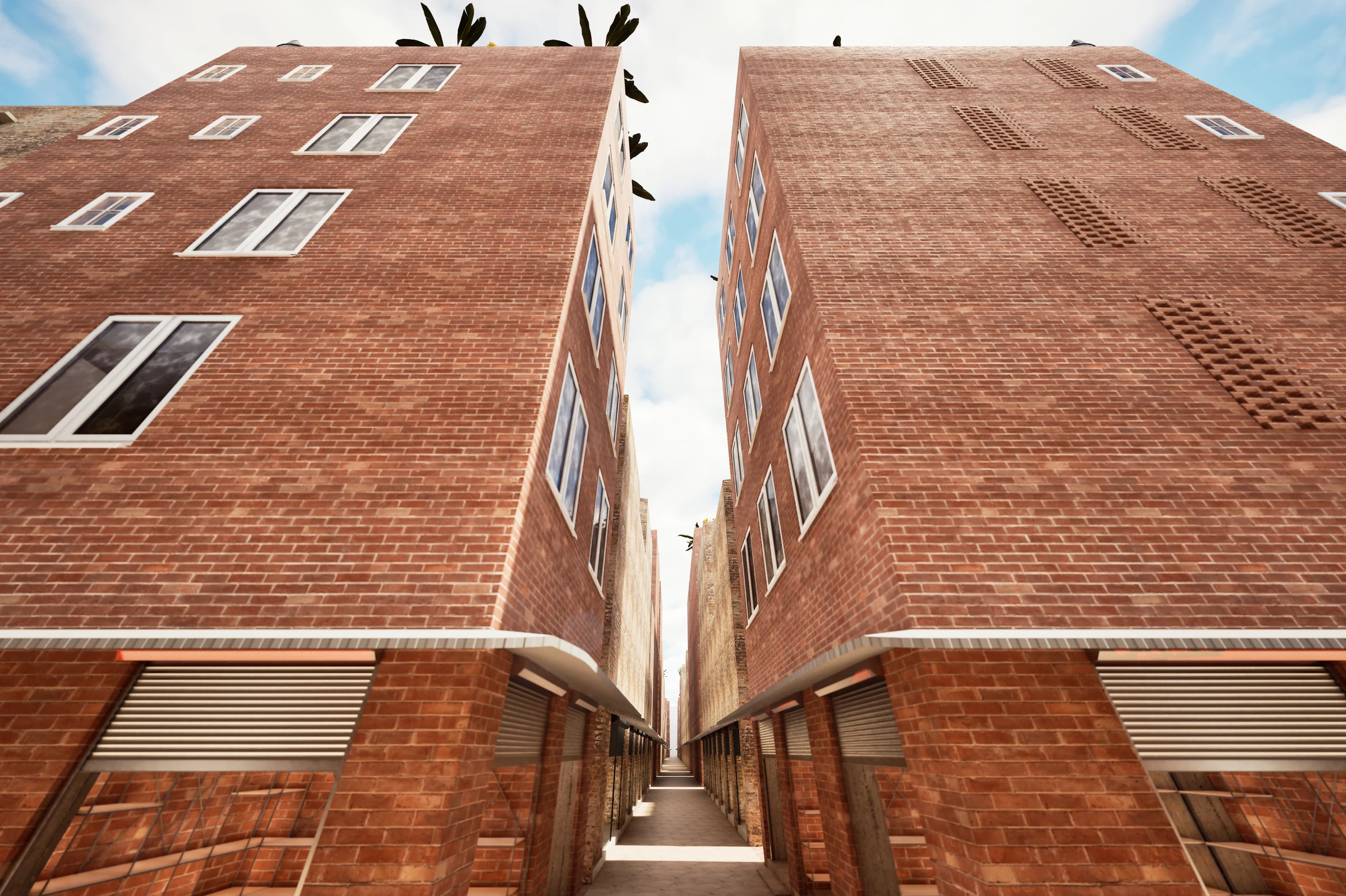
Existing vs. Proposed
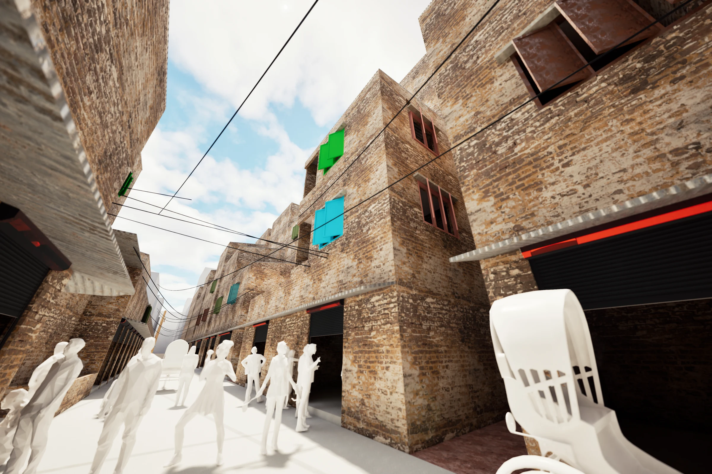
Five viewpoints recorded across the camp: each rendered twice: once as the existing condition, once as the proposed intervention. The camera does not move. Only the architecture does.
Floor Plans & Sections
Renders