Indigenous Architects · Cox's Bazar · 2021
Mixed Use
Tourism Center
A waterfront island parcel on the Bakkhali River, minutes from Cox's Bazar Airport and the long beach. The brief asked for a self-contained tourism centre: hotel, condominium, convention and commercial space, and a low-rise resort, gathered into one composition without losing the porosity of a seaside town.
The plan reads as a ring. Private programmes—hotel and condominium towers, resort villas—occupy the perimeter where the views are widest. Public programmes—convention hall, commercial frontage, information and reception—face the road and the bridge approach. Between them sits a central courtyard organised around a lake: an elevated plaza for arrival, then water, then a green podium that knits the two halves together. The lake is engineered as a tidal basin, drawing the river into the heart of the complex.
The site sits inside a coastal pattern of fish farms, salt pans and tidal channels. The masterplan accepts that pattern rather than flattening it: water is brought inside, planted edges absorb the seasonal flood, and the elevated plaza keeps the public programmes above the high-water line. The convention block crowns the composition, its triangular roof oriented towards the bridge so that arrival reads as a single architectural gesture from the Cox's Bazar – Chittagong highway.
Area Context
The site reads against a triangle of regional landmarks: Cox's Bazar Airport to the west, Kalatuli Beach and the Bay of Bengal to the south-west, and the Bakkhali Bridge to the east. Kasturi Ghat, the historic jetty on the Bakkhali River, sits immediately west, with the future development zone laid out across the river to the north.
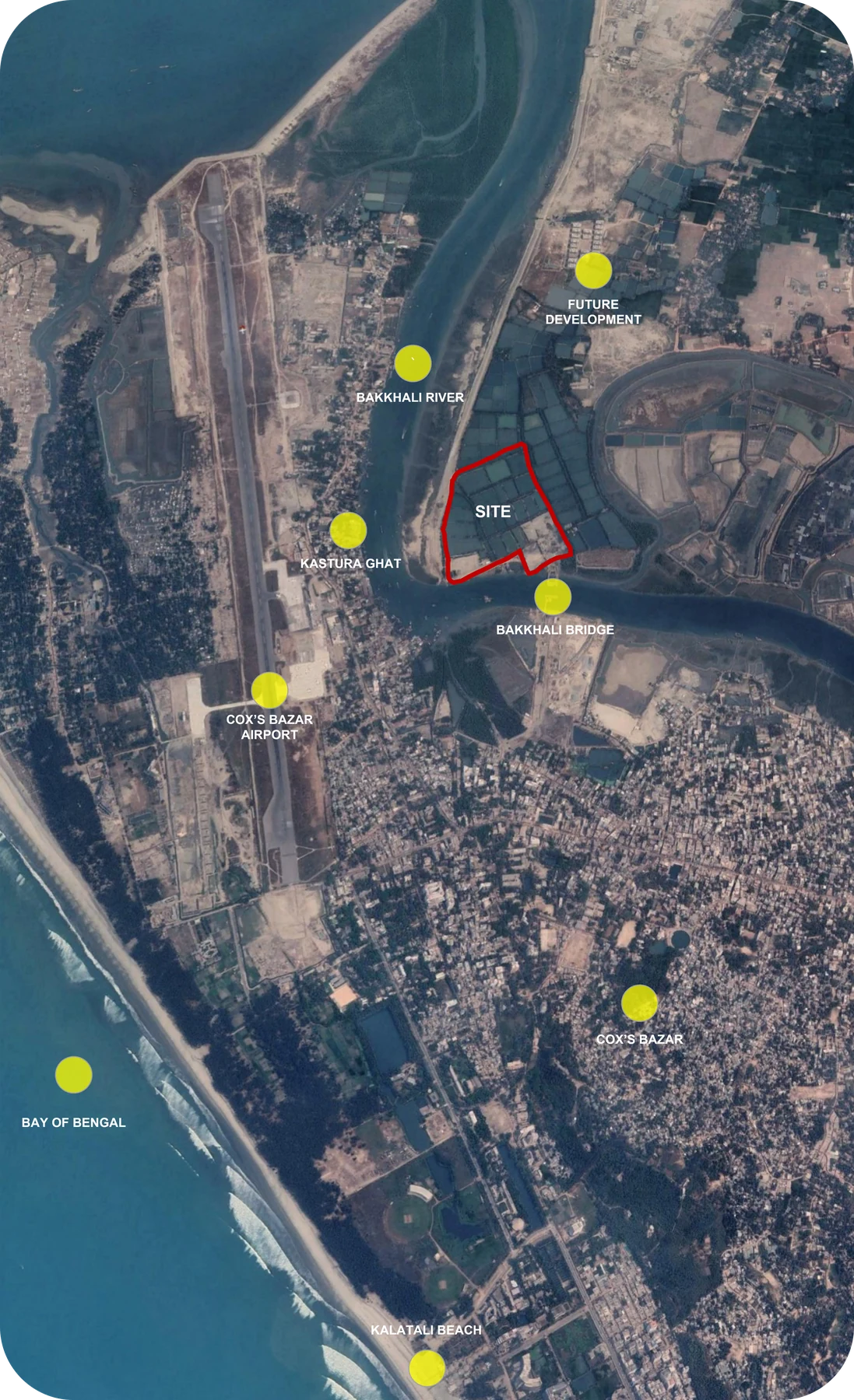 Regional Context · Bakkhali River, Cox's Bazar Airport and the Bay of Bengal
Site
An island within the Bakkhali estuary, accessed by the new bridge and ringed by tidal channels, fish farms and salt pans. The site is low and exposed: any ground intervention had to negotiate seasonal flooding and the asymmetric relationship between the road edge (urban, hard) and the water edges (soft, tidal). The masterplan keeps the public ground level above the high-water mark and lets the lake do the work of buffering the rest.
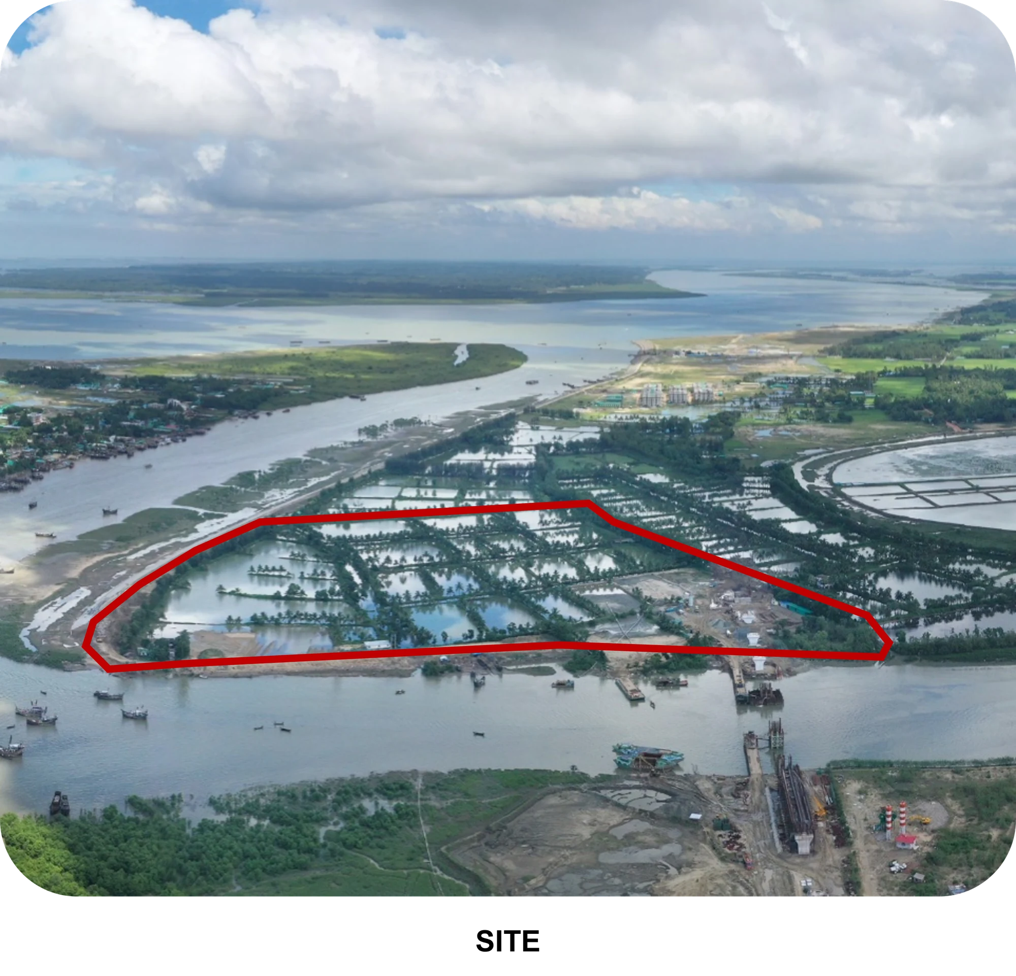 Existing Site Condition · Tidal Island within the Bakkhali Estuary
The Design
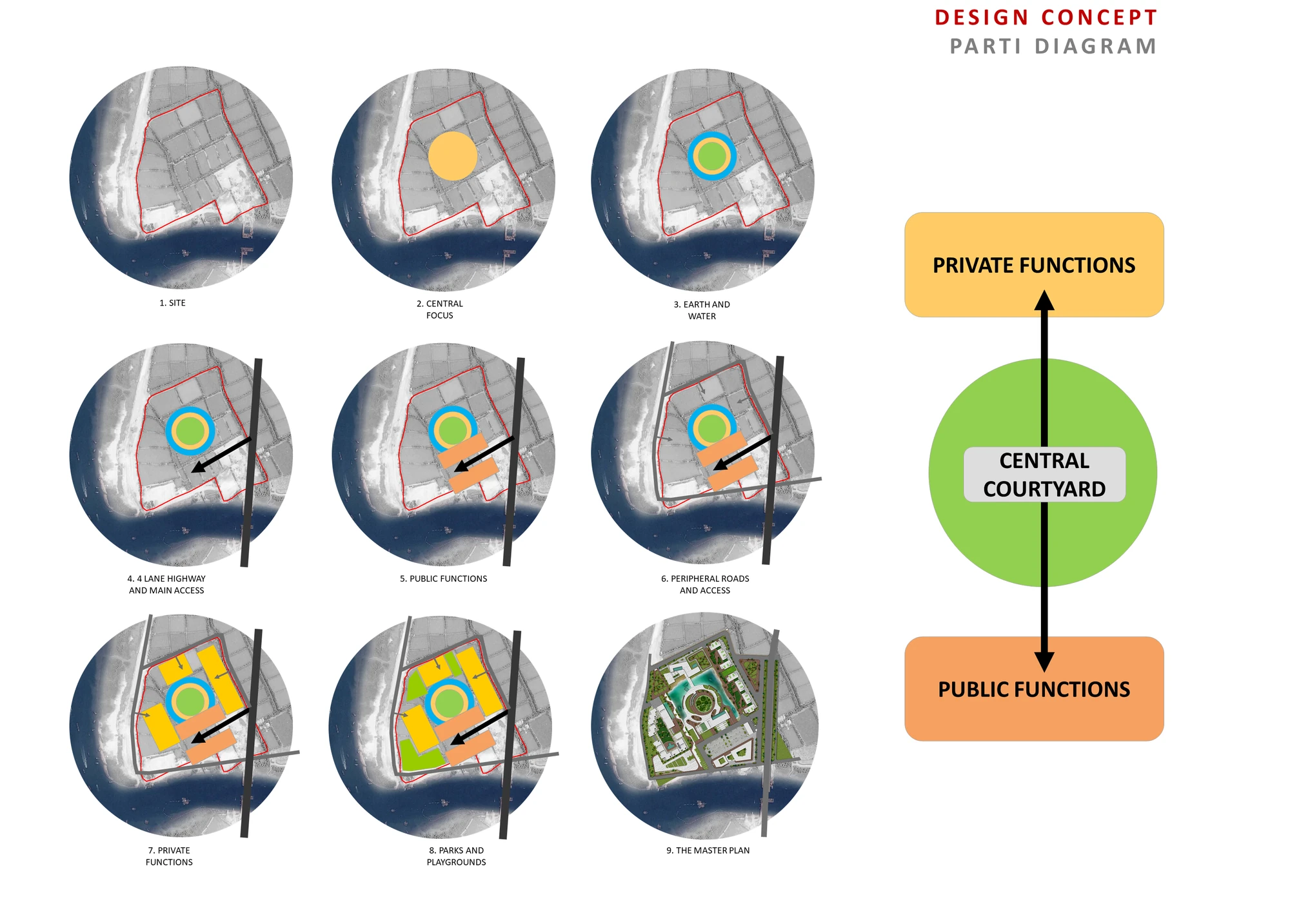 Parti Diagram · Public and Private Bound Through a Central Courtyard
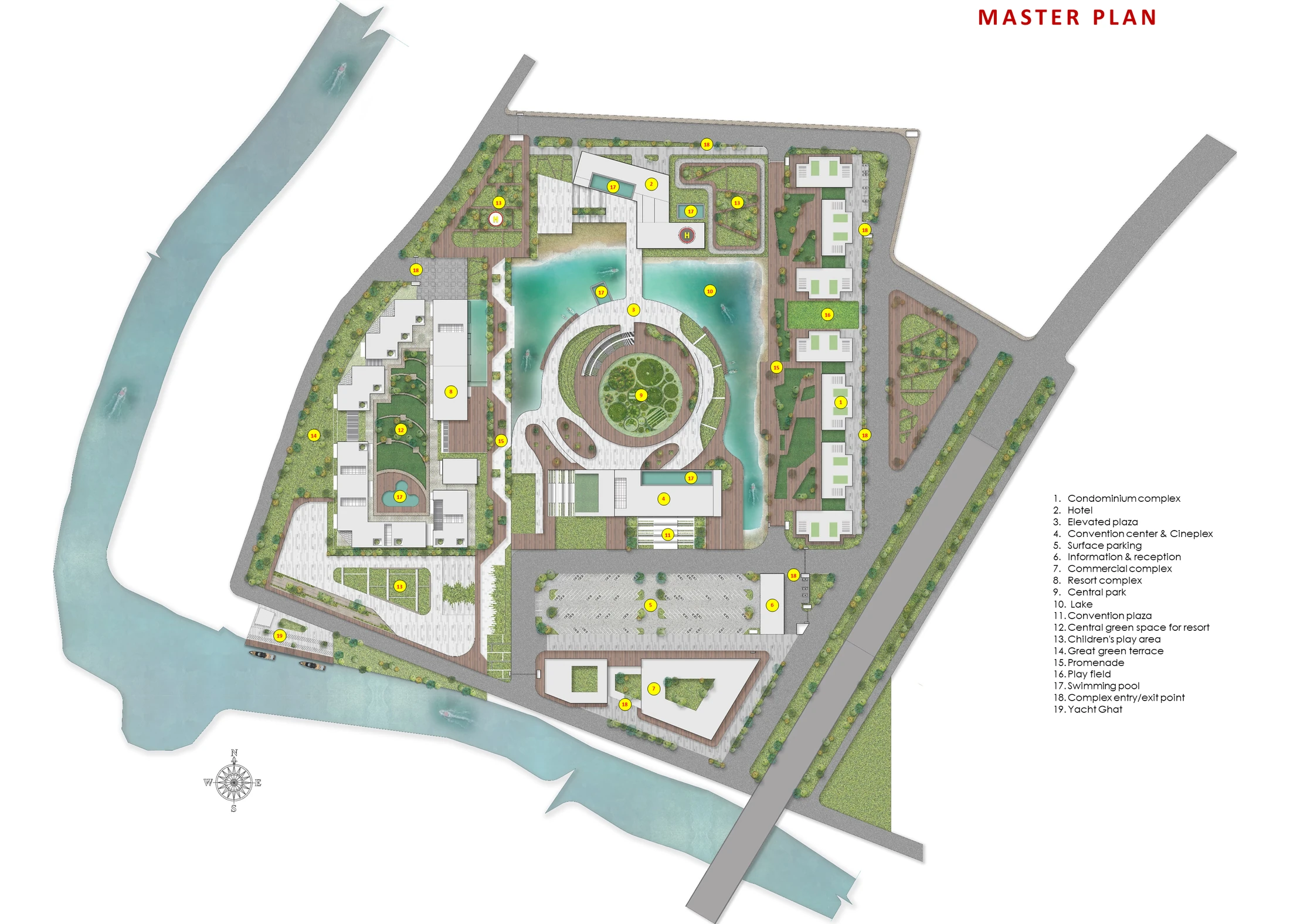 Master Plan · Nineteen Elements Organised Around the Central Lake
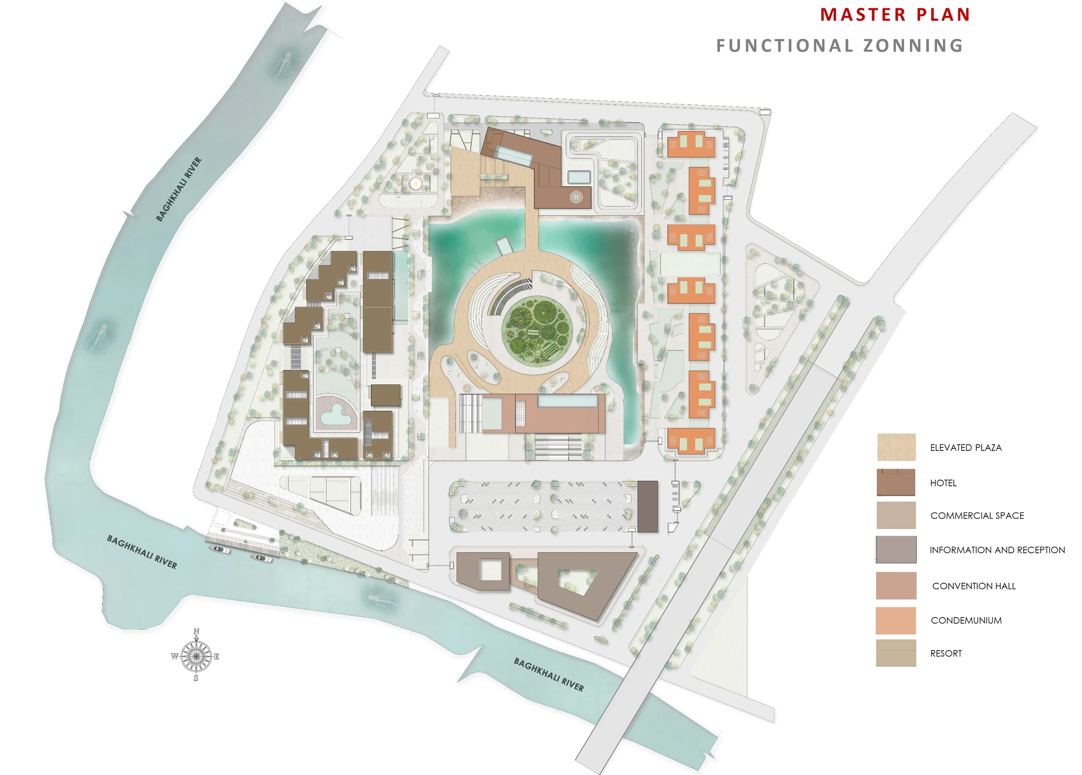 Functional Zoning · Seven Bands Around the Lake
Visualisations
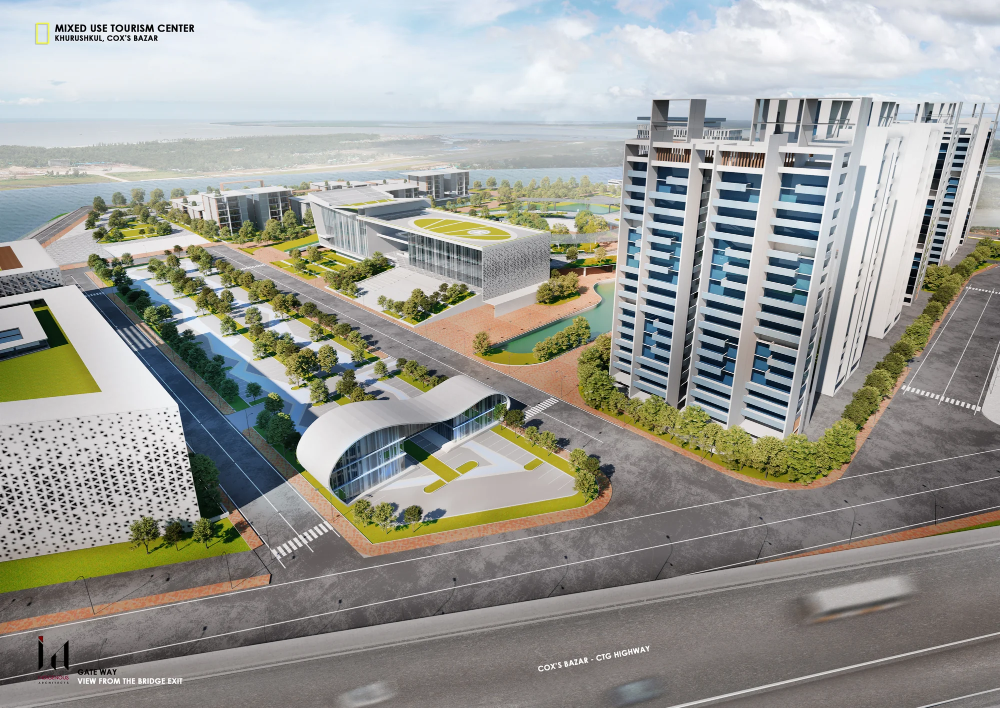 Bridge Bay · View from the Highway Approach
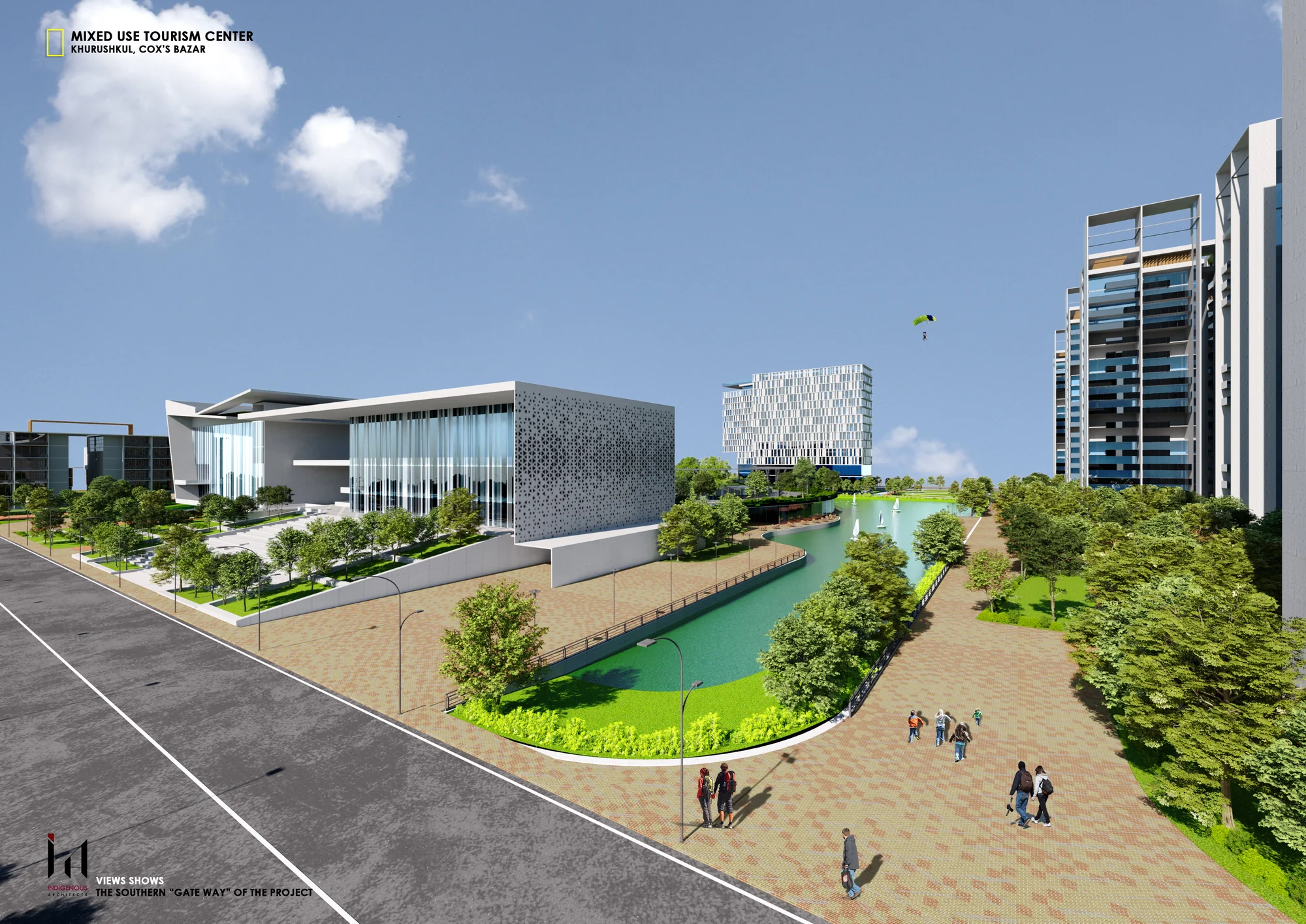
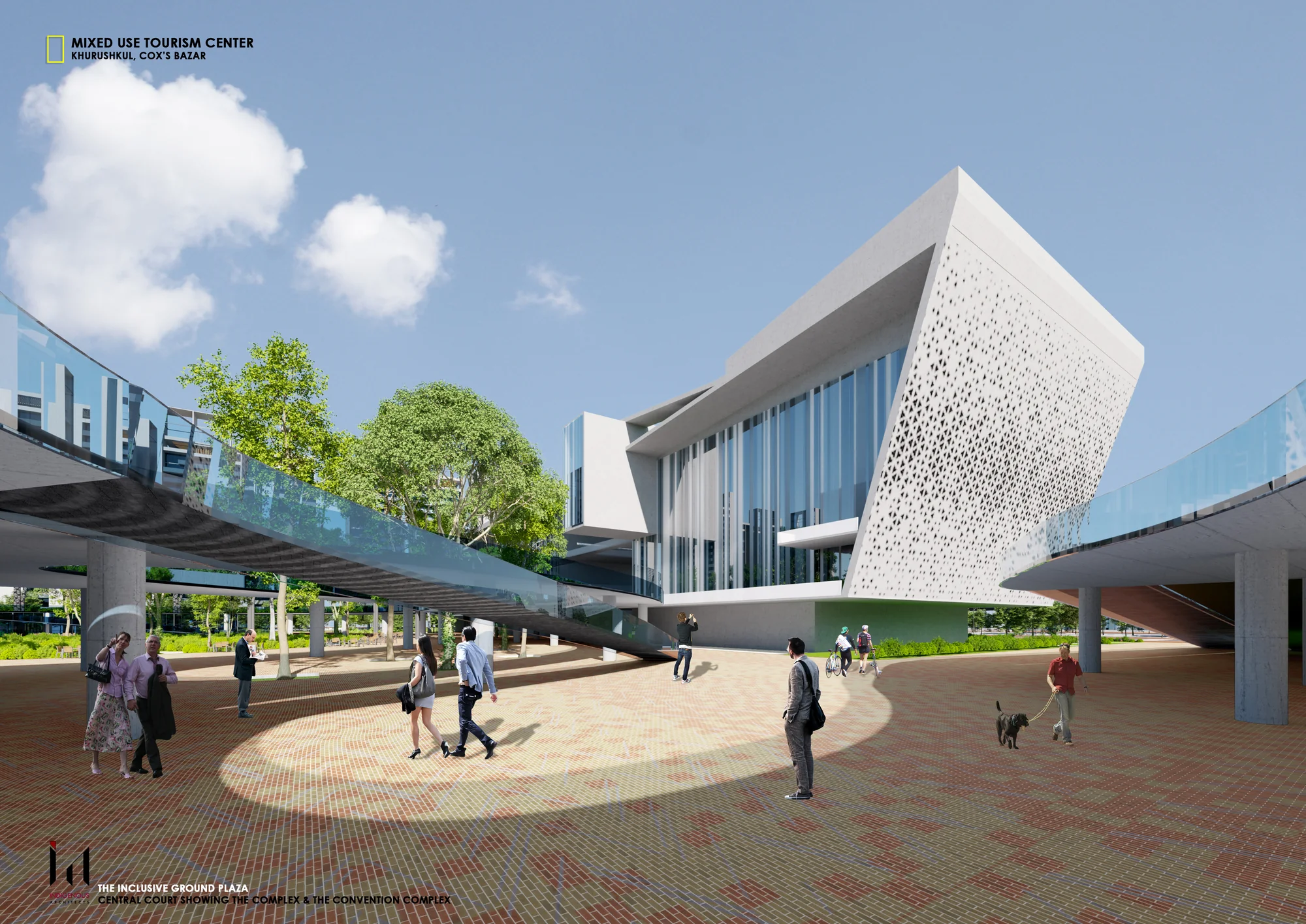 Inclusive Ground Plaza · Entry to Convention + Commercial
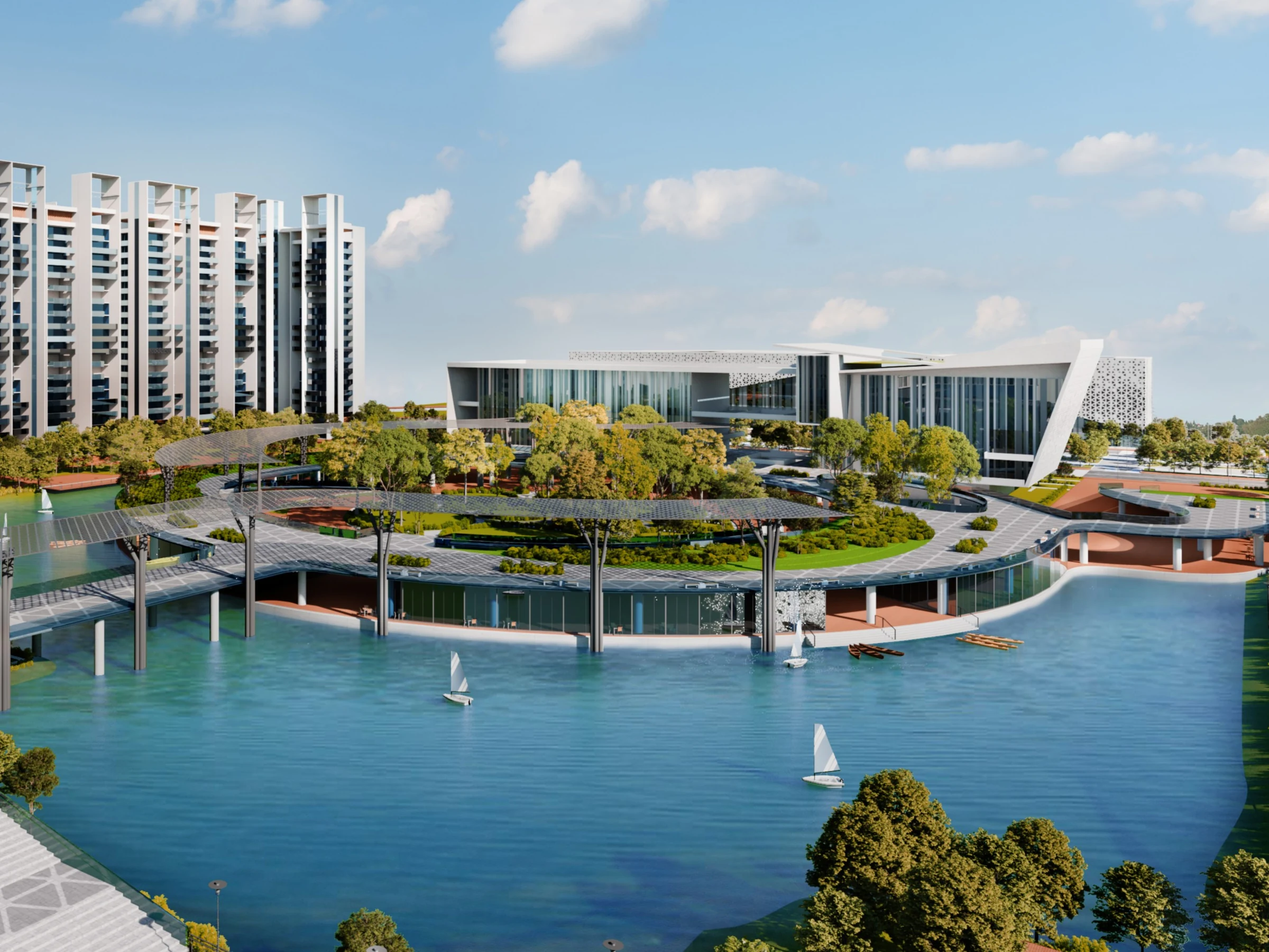
 Lakefront Promenade · Soft Connection to the Plaza
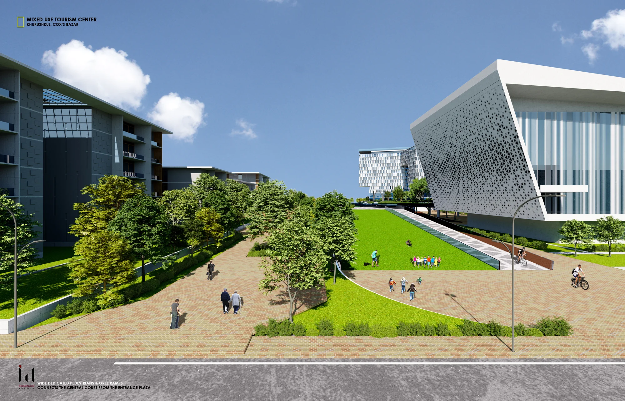 Central Park Approach · Connecting Court to Plaza
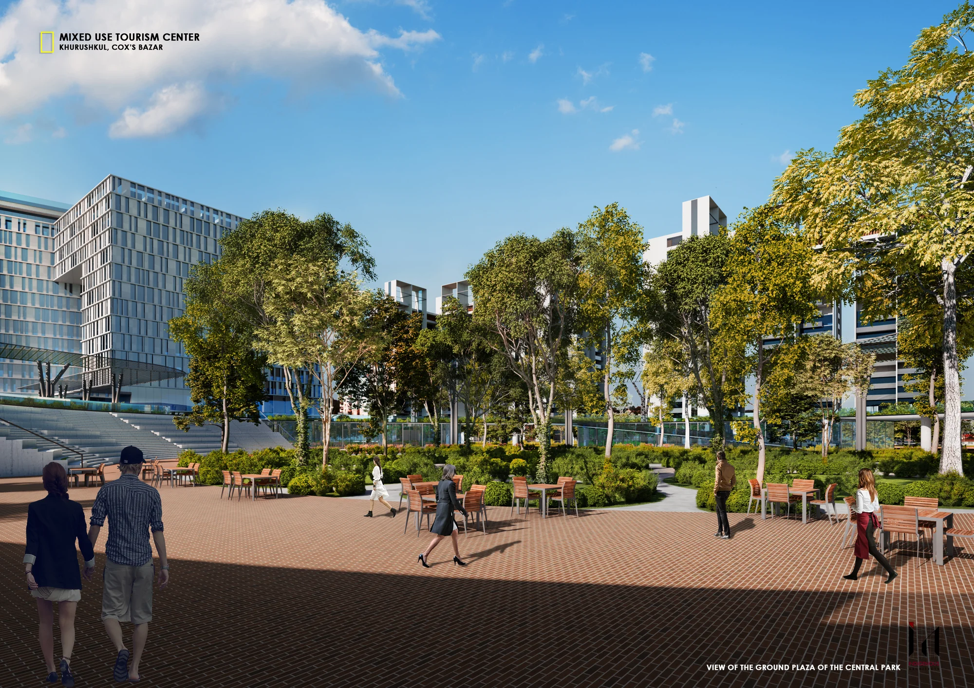 Central Park · Ground Plaza Looking Through the Trees
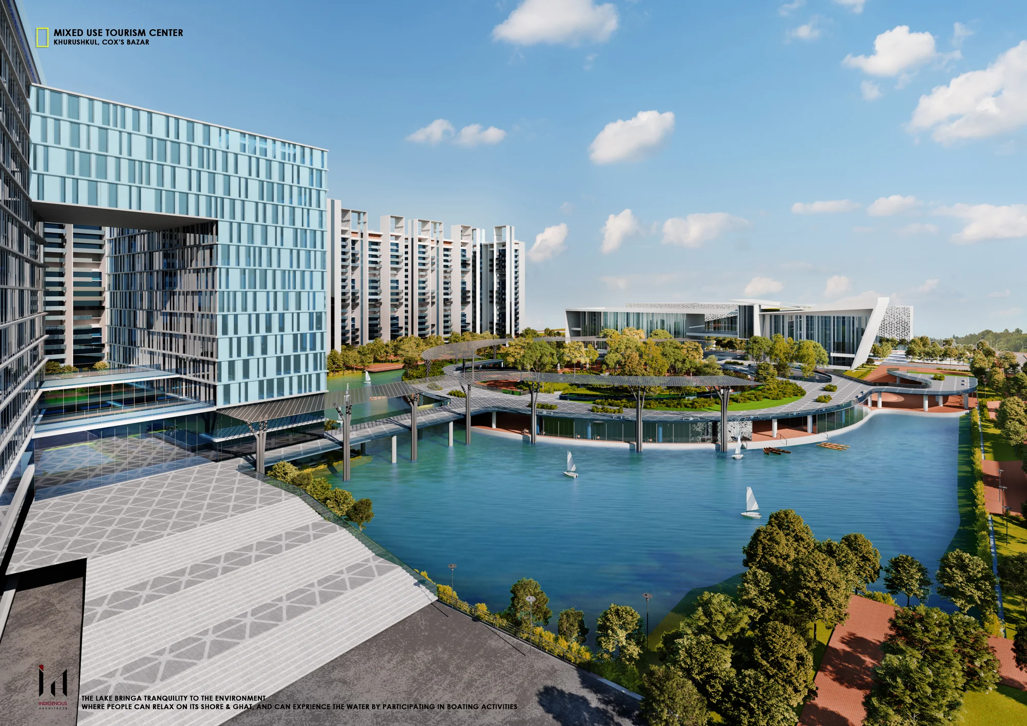 Lake Courtyard · Tranquillity at the Heart of the Complex
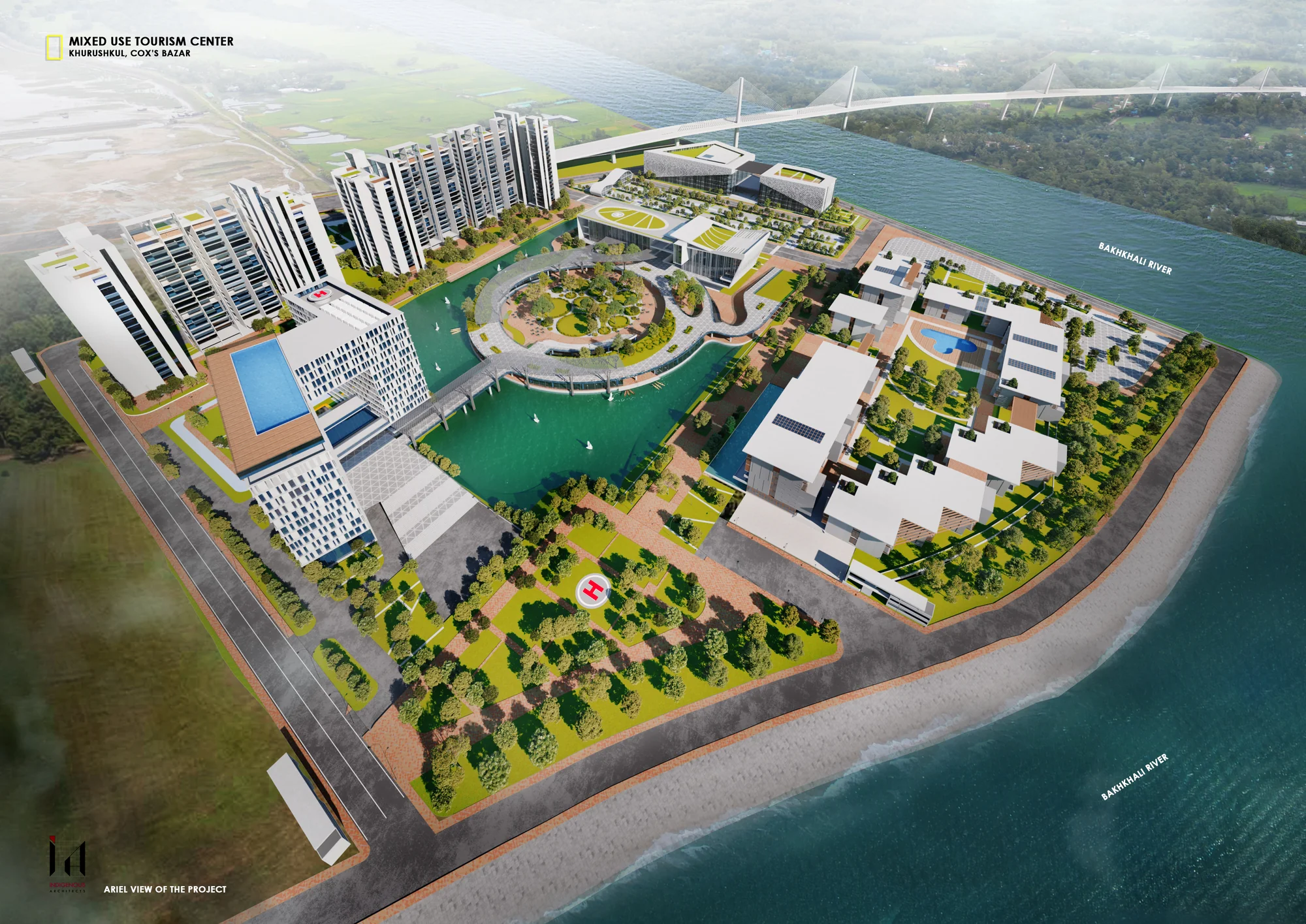 Aerial · Rear View Over Resort and Lake
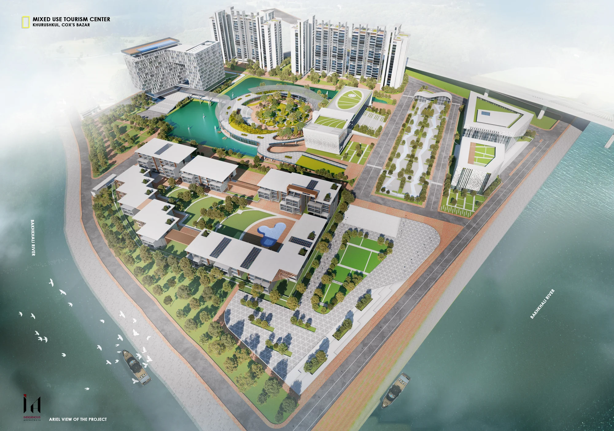 Aerial · Project, Bridge and River
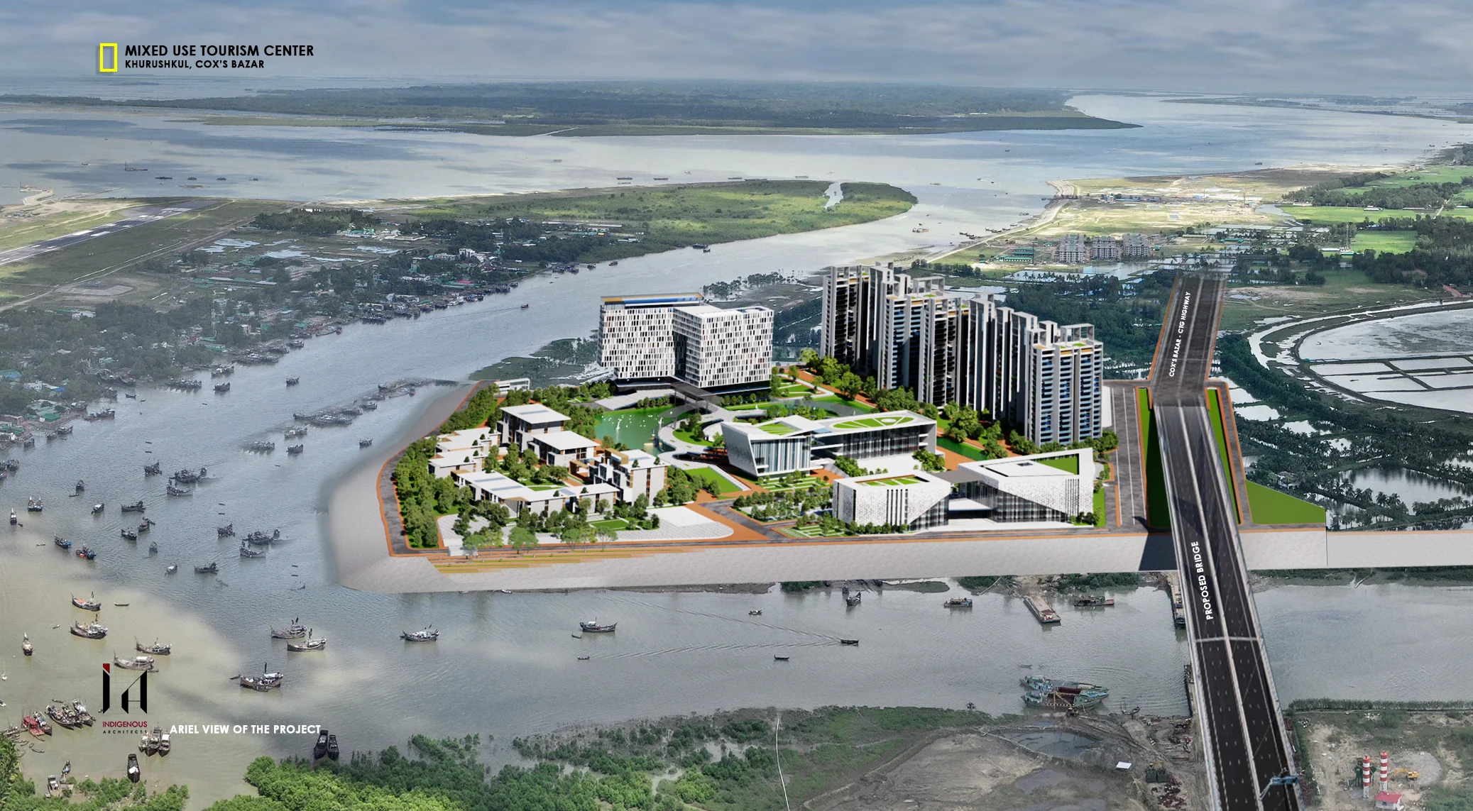 Aerial · Project and Cox's Bazar Airport Context
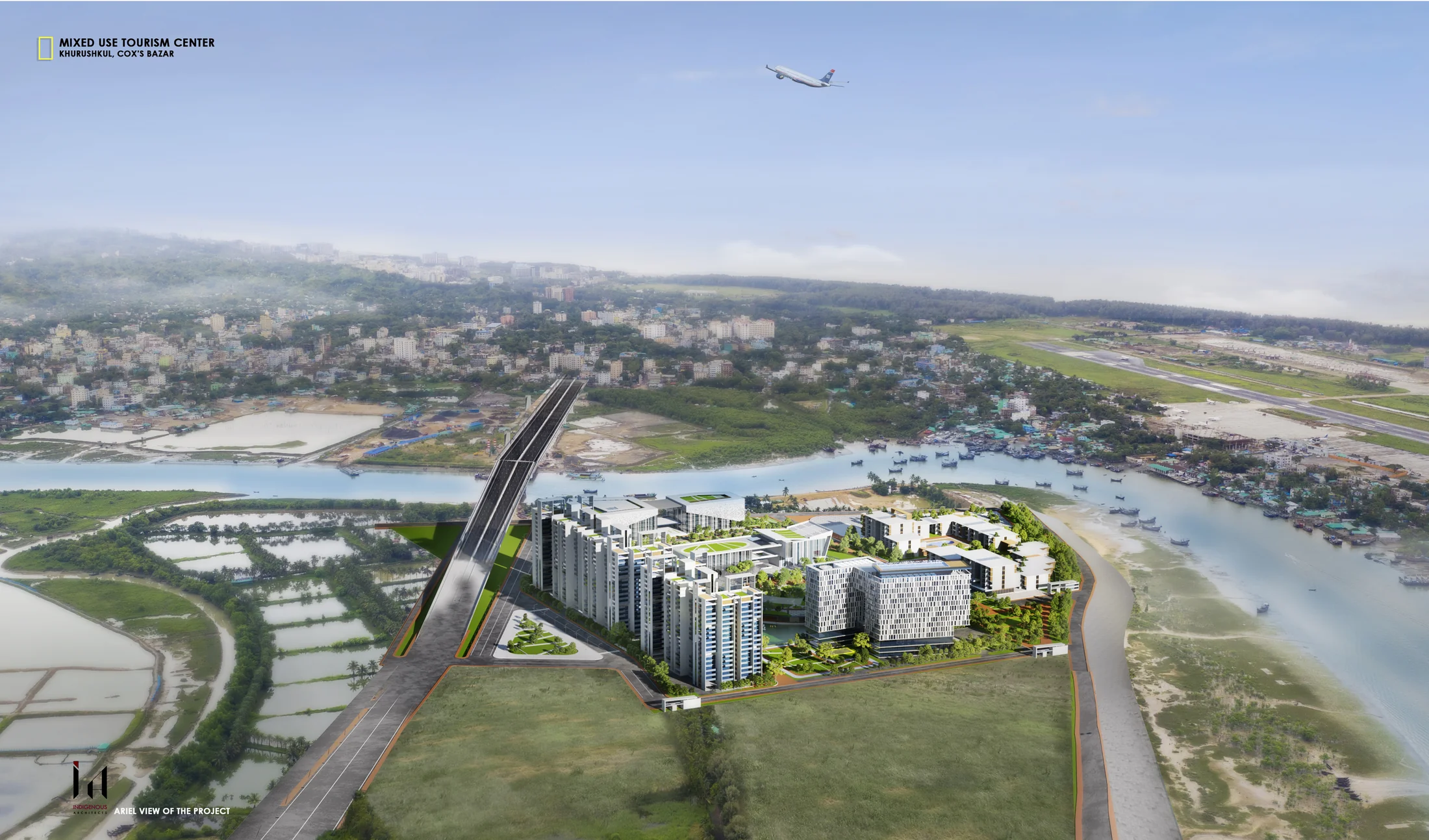 Aerial · Regional Reading from the Estuary